Be warned: Due to the ongoing conflict, I do not recommend visiting Ukraine at the moment, particularly in the east. Some western areas, like Lviv, are generally safer, but there is always a risk of the conflict spreading and spilling over to the west. If you choose to visit, please do so at your own risk and take all necessary precautions.
Are you looking to go hiking in Ukraine? If so, there is no better place to hike than in Yaremche, a town in the middle of Ukraine's stunning Carpathian Mountains.
When I was traveling in Ukraine, I didn't find any information at all about hiking in Ukraine's Carpathians, so I decided to set out on my own. I chose Yaremche as a base and went off to hike some of the trails around Yaremche.
I'm here to report that I may have found the best base for you to go hiking in Ukraine's Carpathians. Yaremche is located right in the middle of the Carpathian Mountains, southwest of Lviv.
It is easily reachable by train from Lviv and has an amazing trail with an epic panoramic view that you can walk to from the town, as well as close proximity to Hoverla (2,061m), the highest mountain in Ukraine that you can climb.
Yaremche may be the best hiking town in Ukraine's Carpathians, and so here is the ultimate hiking guide to Yaremche in the Carpathian Mountains in Ukraine that will answer all the burning questions you have about hiking in the Ukrainian Carpathian Mountains.

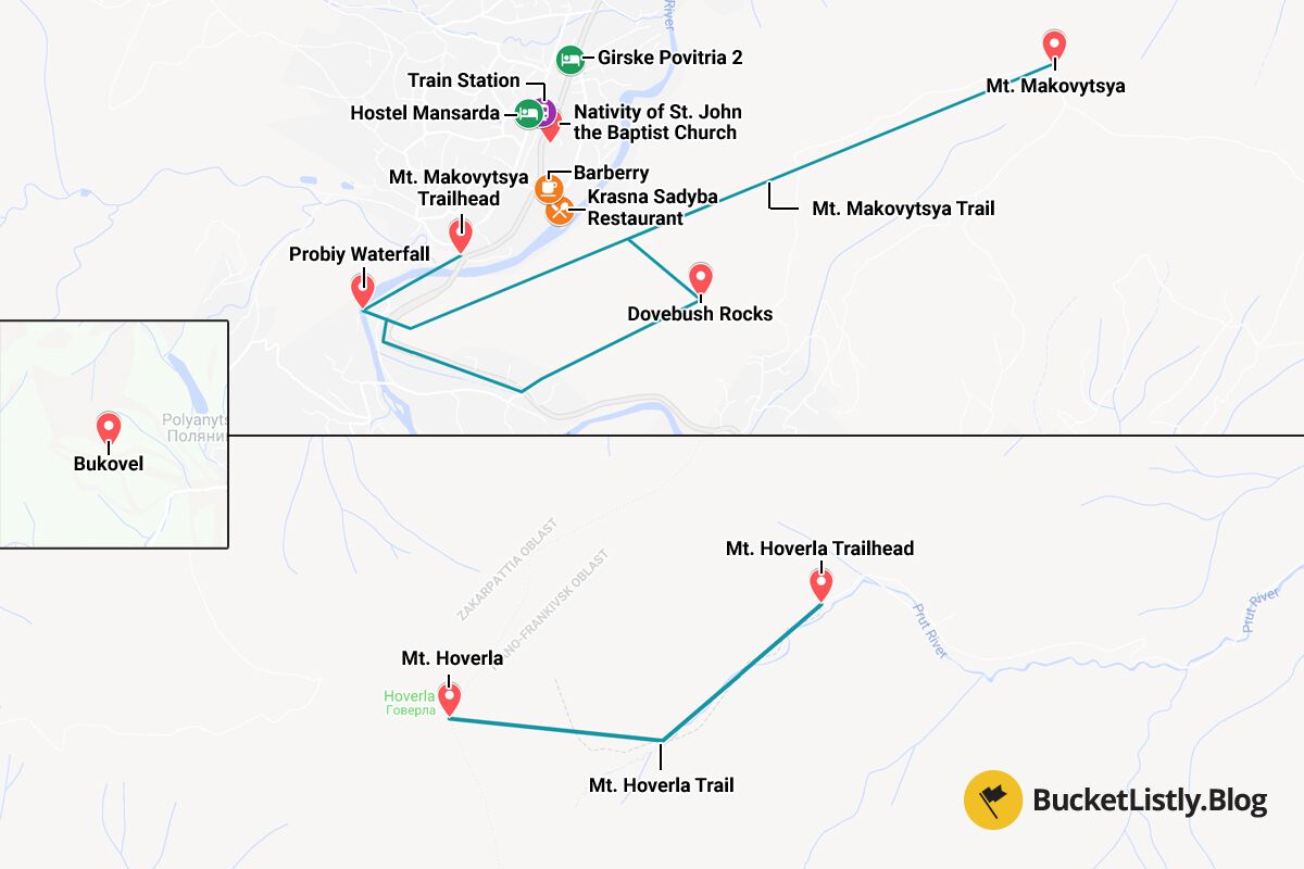
Ukraine's Carpathians Hiking Trails Map
Quick Summary
| 🌤️ Best time: | May-September |
| 🚘 Get around: | Bus and hiking |
| 🕓 Time to spend: | 2 days |
| 🚶♂️ Difficulty: | Easy to moderate |
| 💰 Cost: | 1618 UAH |
Recommended Hiking Trails for the Carpathian Mountains in Ukraine
Hiking Makovytsia Mountain in Yaremche
Hike Time: 4 hours (round trip)
Difficulty: Easy to moderate.
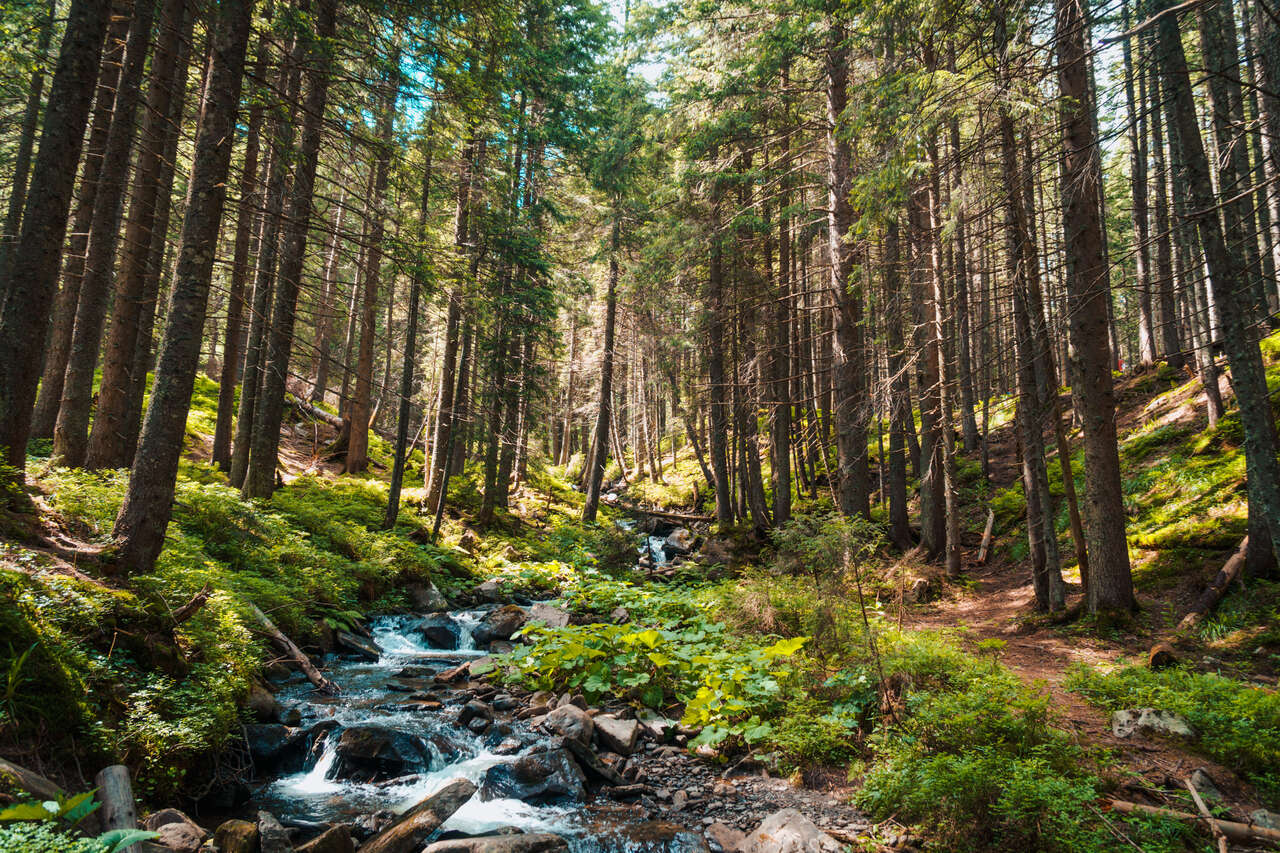
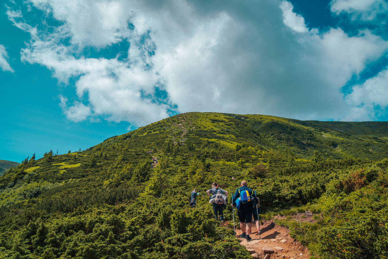
The first hike I would recommend you to do is the Mt. Makovytsia trail. The trail starts from Yaremche as you head south along the railroads across the Prut River bridge.
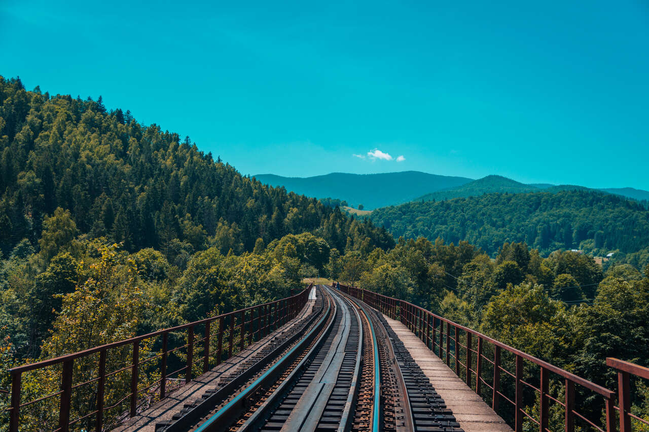
You will have a chance to explore one of the attractions in Yaremche here before you start the trail. As you walk along the railroad southward, you will arrive at a parking lot on your right leading to Probiy Waterfall. Now you have the option to go right to the waterfall or go left across the road up to Mt. Makovytsia trailhead. For now, we will follow the hiking trail and leave Probiy Waterfall for later.
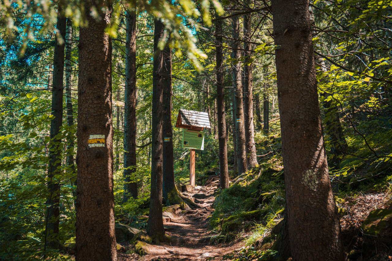
After crossing the road, you will arrive at a ticket booth where you will have to pay a 30 UAH fee for park entrance. Once you have entered the park, simply follow the well-marked trail up the mountain. Now, you are on your way to the summit of Mt. Makovytsia.
For about 15 minutes, you will arrive at an observation deck where you will get a glimpse of the view of Yaremche from above. However, you are still 2 hours away from the summit, so do not rest for too long.
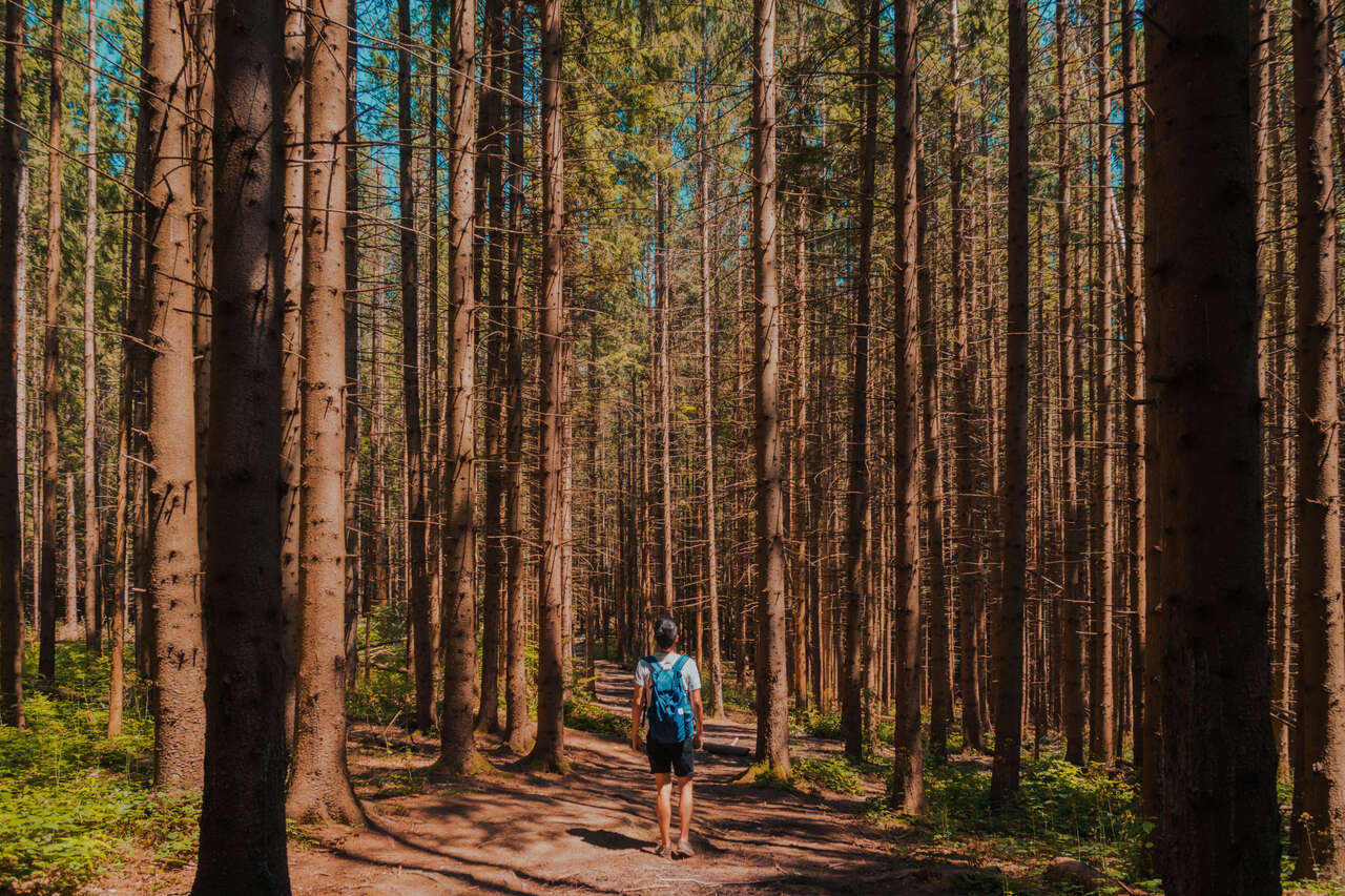
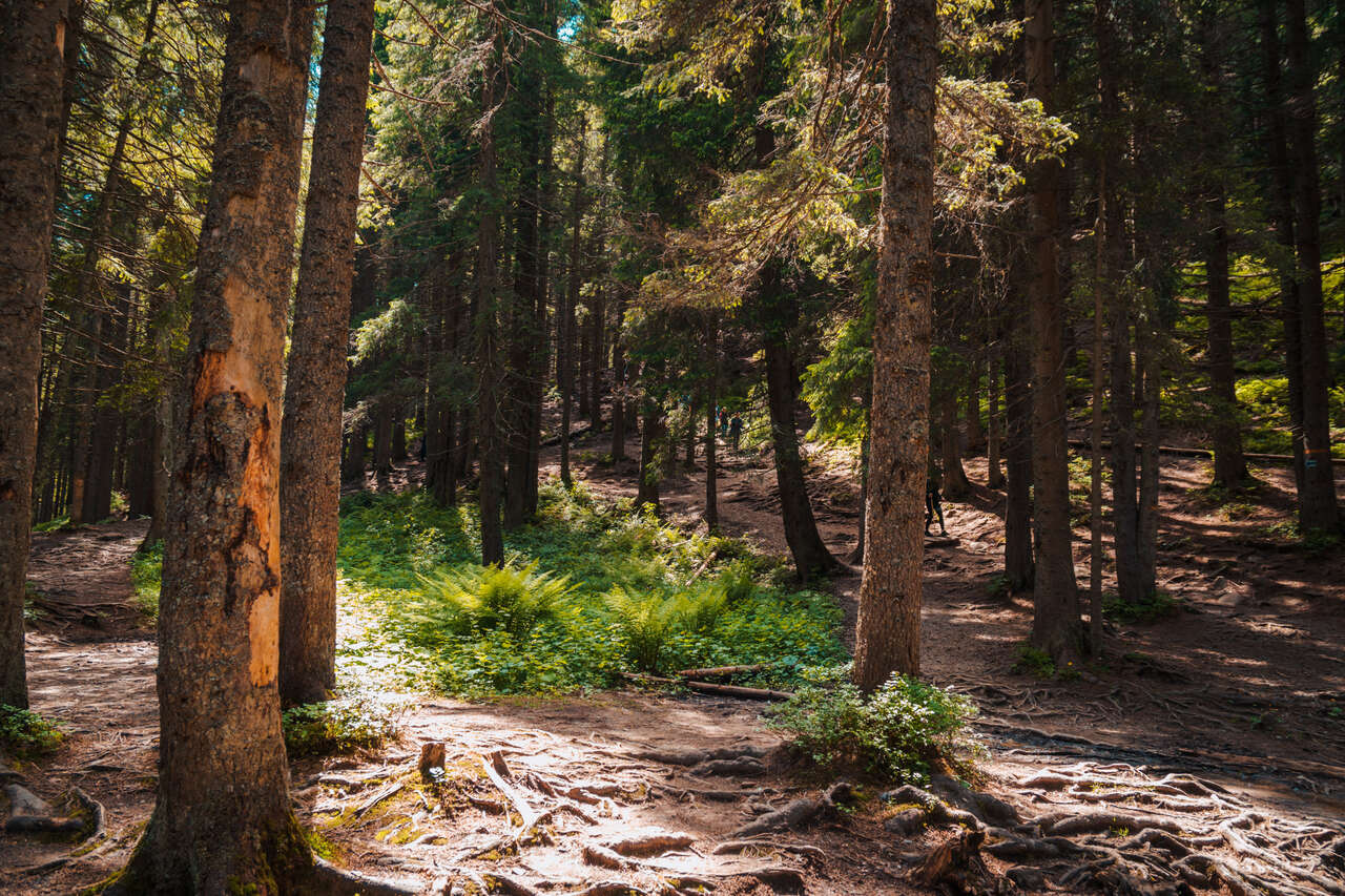
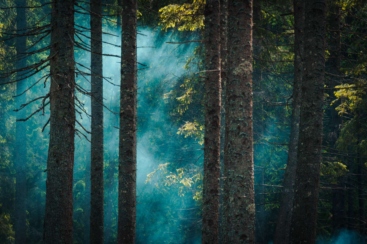
From there, it's a steady climb up the mountain. Thankfully, the trail here is mostly under tall trees, which help alleviate the heat from direct sunlight a bit.
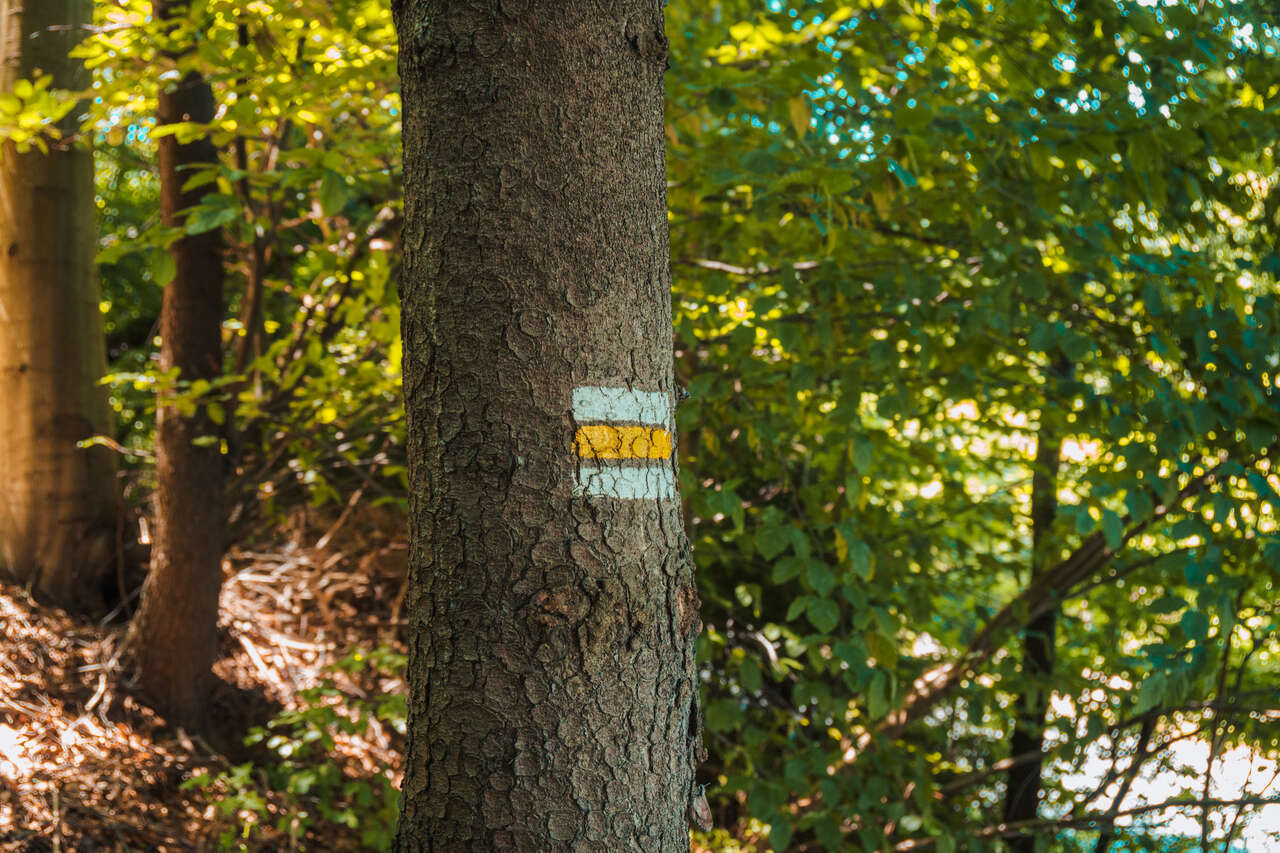
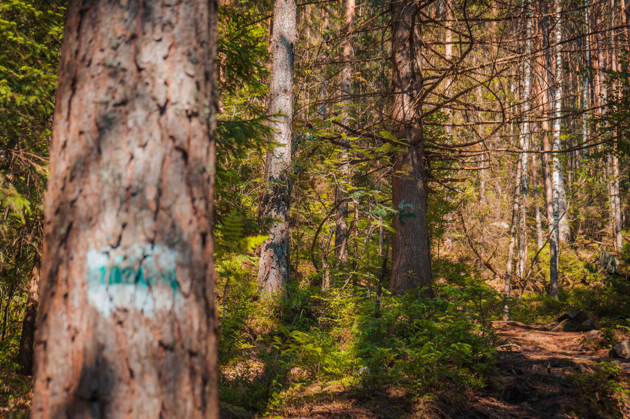
If you think you might get lost, be sure to follow these yellow-white stripes painted on trees and rocks along the trail. If you are still unsure, you can rely on Maps.me, as I did, and just follow the trail shown on the app.
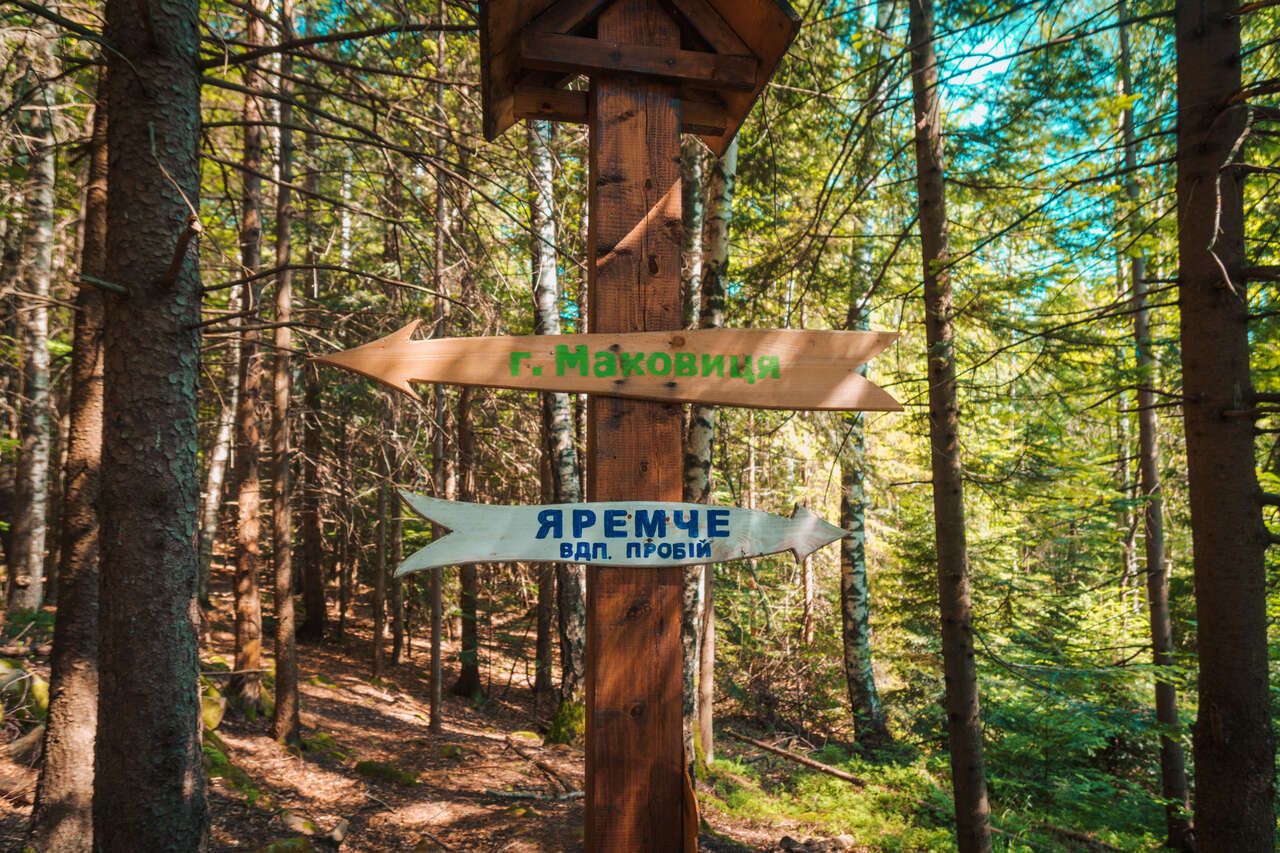
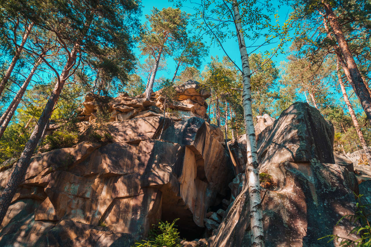
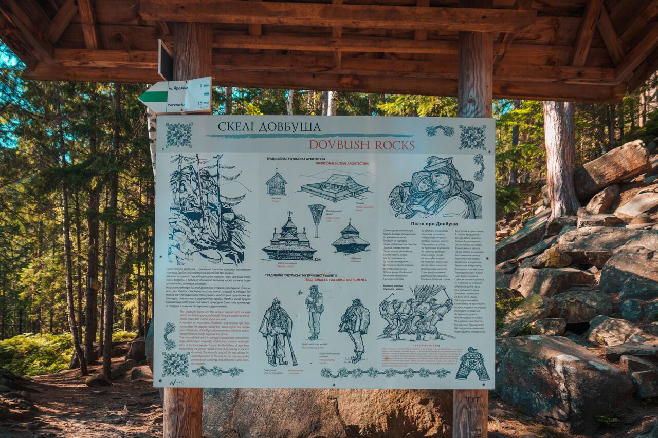
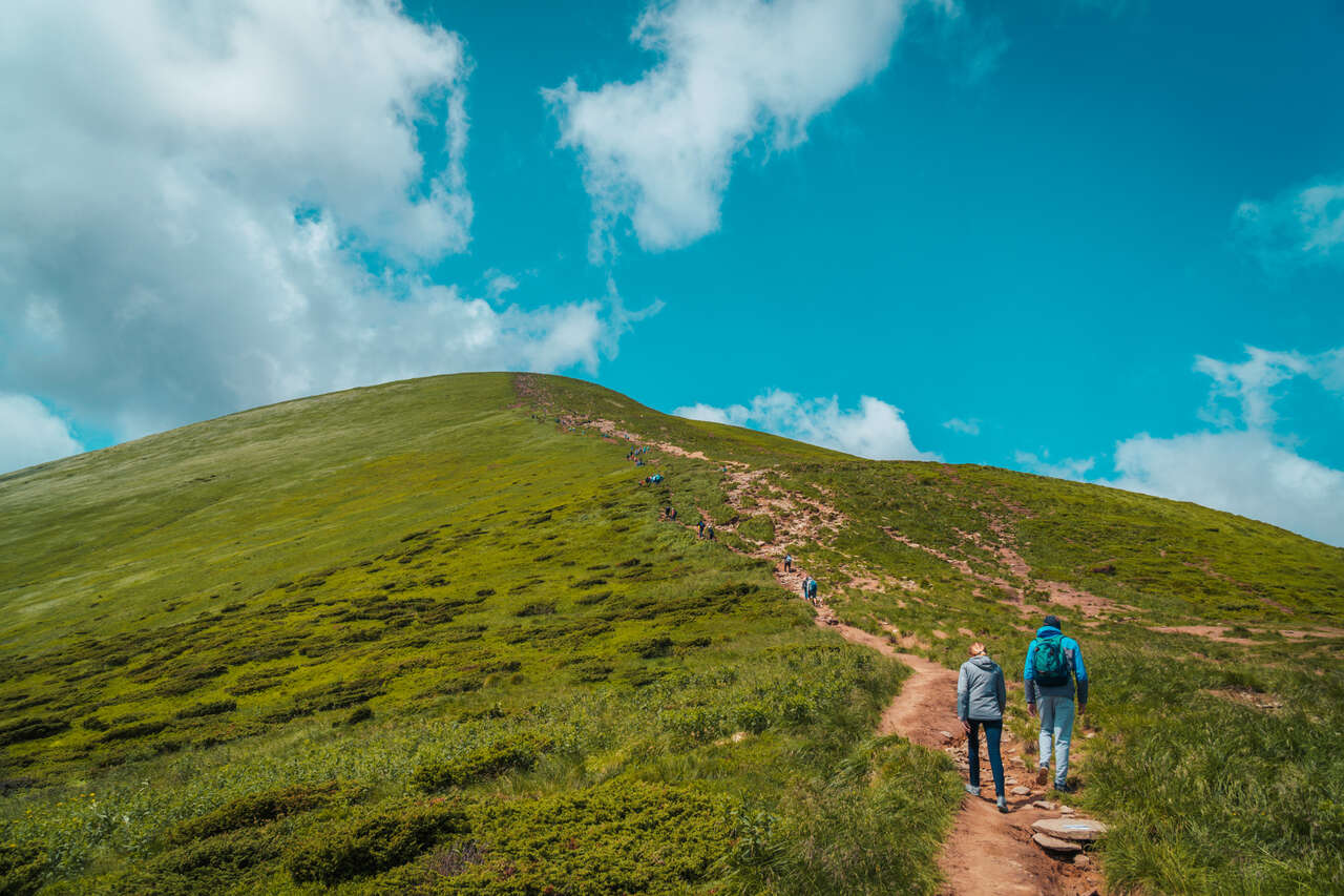
Occasionally, you will find a sign pointing to "Маковиця", which means Makovytsia in Cyrillic. After hiking for about 45 minutes, you will have the option to go right and continue on a side trail toward Dovbush rocks. We can leave that for when we are coming down.
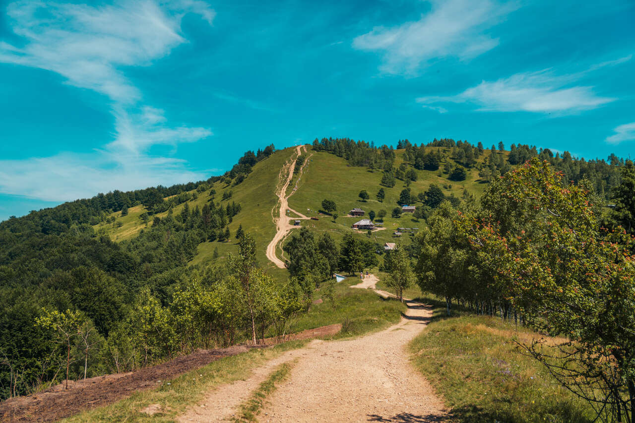
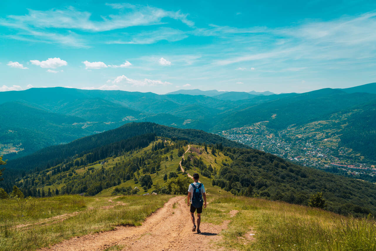
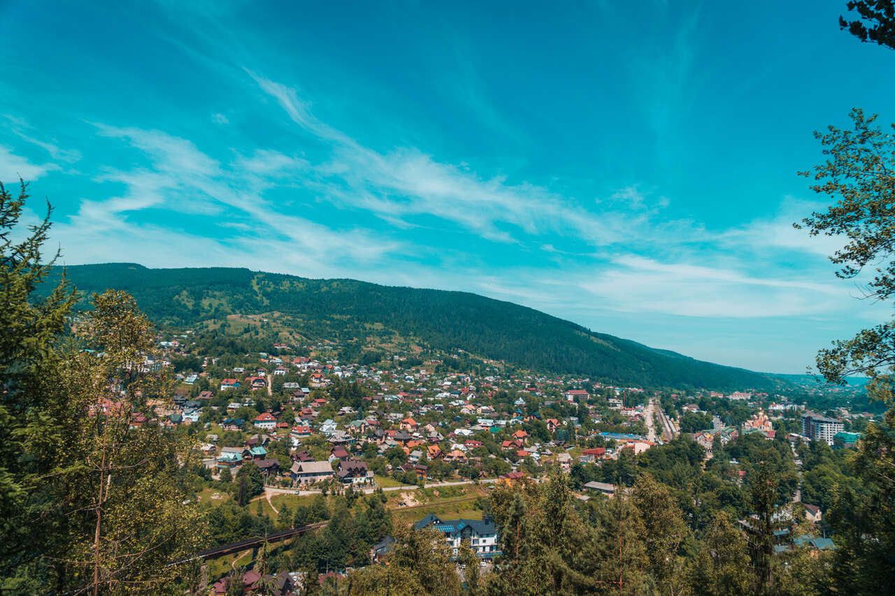
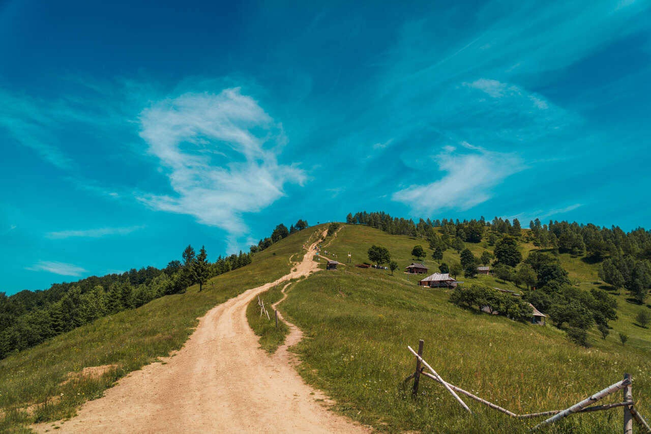
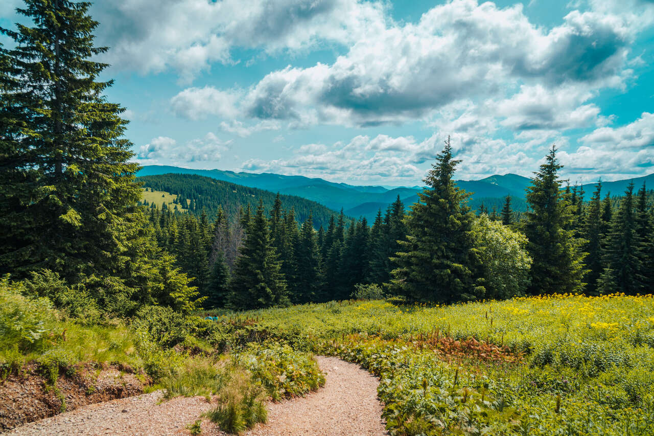
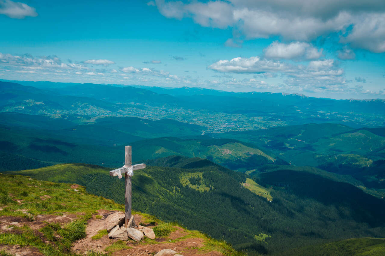
Hiking up for another 45 minutes, and you will arrive at a ridge where the trail becomes exposed. From there, you will be able to see the summit of Mt. Makovytsia as well as Yaremche from above, a view that will get better and better as you climb.
From there, the trail should be very clear, and all you have to do is follow the path for another 20 minutes until you find a cafe. You can rest here for a bit, or you can continue for another 10 minutes to the top.
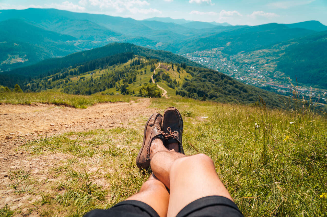
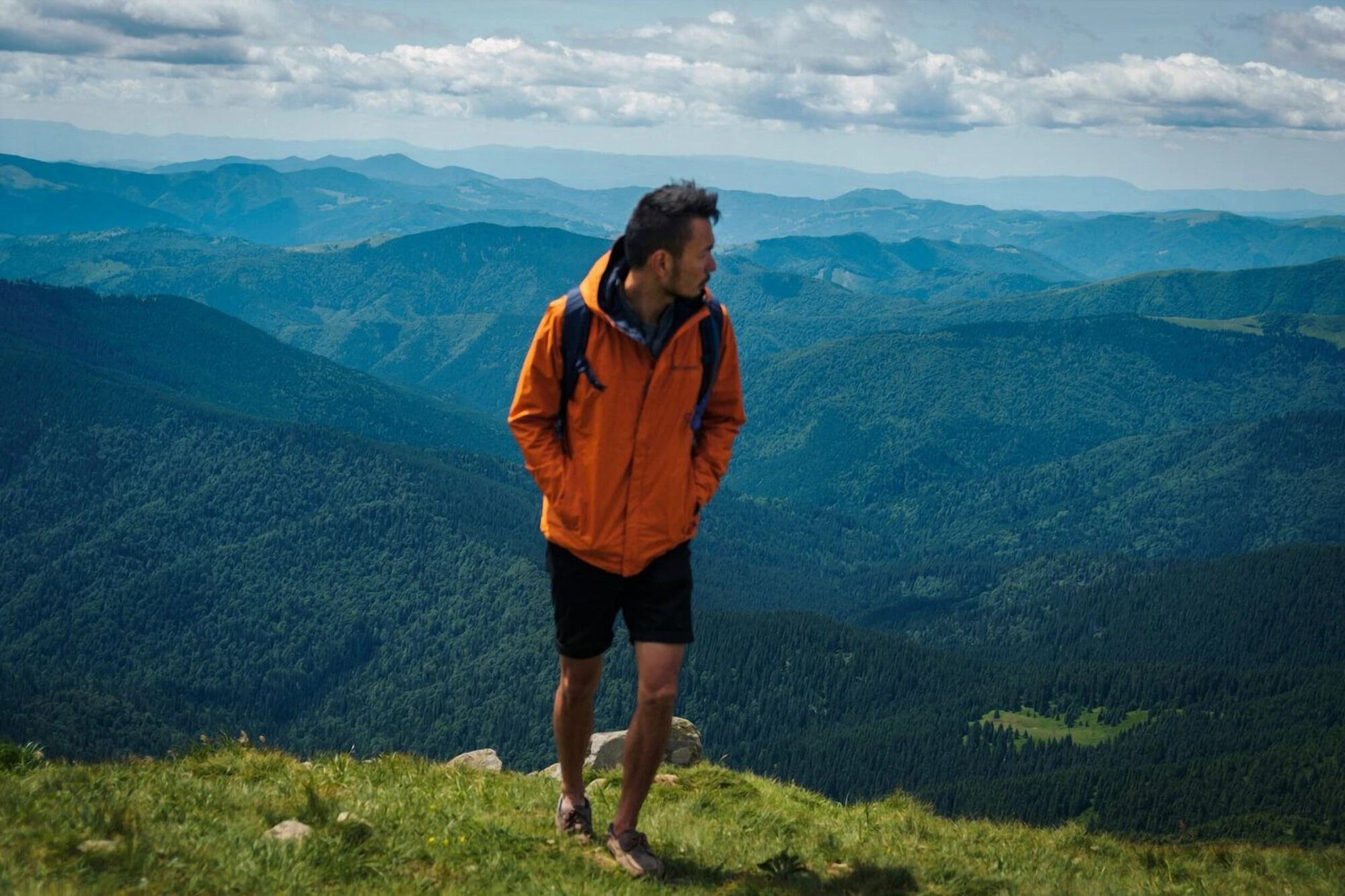
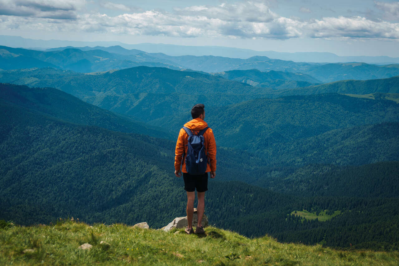
This large stretch is quite a steep climb, and you will be directly under the sun for the entire time, making it quite challenging. But once you are up there, you will have one of the best views of the Carpathian mountains, its rolling hills, valleys, and mountains, and Yaremche from above.
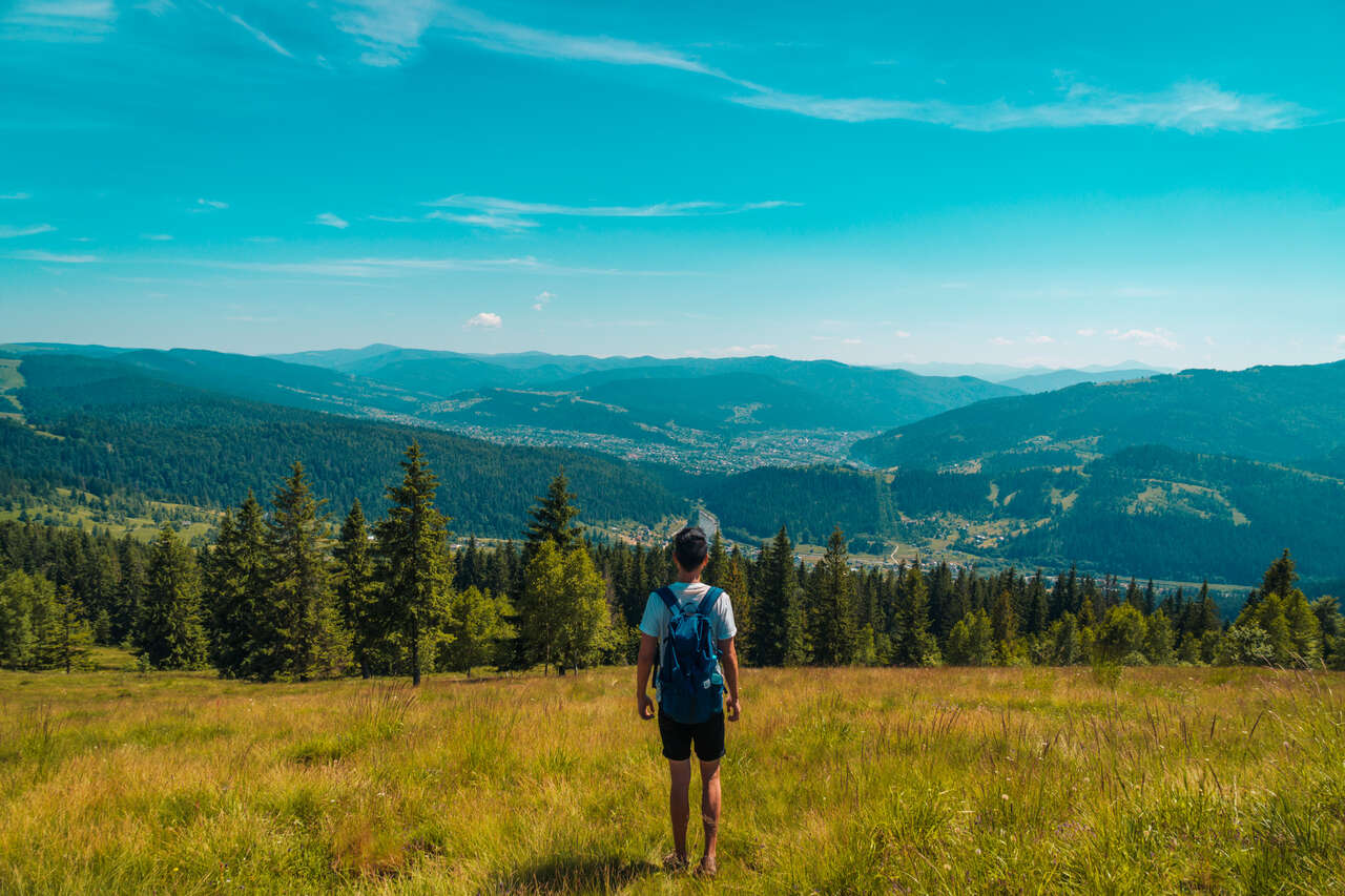
Once you are at the top, you should also continue and walk a little bit south to see the Carpathians from the other side. The green rolling hills of the Carpathians seem to go on forever from this side.
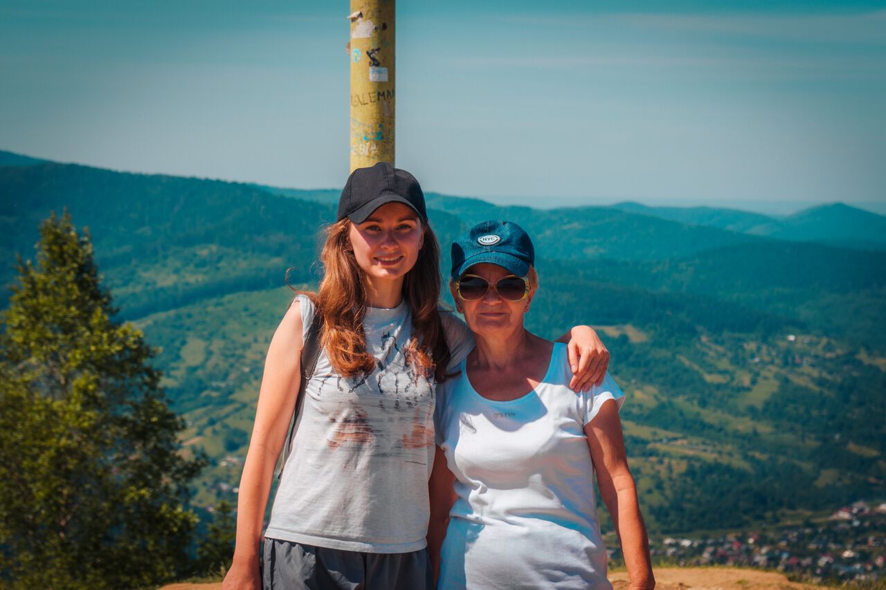
When I was up there, I met a lovely mother-daughter duo from Kyiv who had climbed all the way up from Yaremche together, just like I did. We took a photo together to commemorate our accomplishment. Ukrainians aren't known for being very sociable, but in the mountains, everyone becomes friends, even with the language barrier. I met her again when we took the same train out of Yaremche. A great random memory of the Carpathians.
Now, remember the side trip I told you about previously? We can do that on our way down. Simply follow the trail back the same way and turn right at the intersection located at 48.441974, 24.559603 on the map (input that on Maps.me to see the exact location).
From there, you will have to go left (on your way down) instead of going down the same way and follow the trail to 48.440266, 24.563683 (again, put that coordinate on Maps.me as the location of Dovbush Rock isn't clear on the app), and you will arrive at Dovbush Rock, a significant sight for the history of the people living in the Carpathians back in the day.
From Dovbush Rock, I would recommend that you go south instead of going back the same way, so you can see a different trail on your way back. Go south and stick to your right for about an hour, and you should arrive right back at the highway here.
From there, you can simply walk along the road up north until you arrive at the Probiy Waterfall parking lot again where you can drop by or head back to your accommodation and visit another time. For more information about Probiy Waterfall, check out our Other Things to Do section.
Hiking Hoverla, the Highest Mountain in Ukraine
Hike Time: 5 hours (round trip)
Difficulty: Moderate.
Are you ready to climb the highest mountain in Ukraine? If so, first, you will have to know where Mt. Hoverla's trailhead begins, how hard it is, and how long it will take you to get up there.
As mentioned earlier, you will have to rely on a local tour company to take you there and back, as the Mt. Hoverla trailhead is 50 km south of Yaremche. You can pick any local tour company you find in Yaremche, as they are pretty much the same.
The people selling these tours are often under green or blue umbrellas along the main street in Yaremche, and all you have to do is go up to them. Tell them which day you want to go, and they will tell you where to meet, what time to meet, and what to prepare.
The tour usually begins at 9 AM at the main street opposite the Nativity of John the Baptist Church, and it will take you to the trailhead in about 1.5 hours.
When you arrive at the parking lot, you will have a chance to buy breakfast, coffee, and use the toilet before your hike begins. Since the tour comes with a guide, you will have to wait for him/her to gather the group and explain something in Ukrainian (I wish I knew what my guide was saying). But afterward, you can tell your guide that you are going ahead first if you hike fast or simply follow the group.
In my experience, they were REALLY slow, so I would suggest that you do the same as I did and give your guide a heads up. If you think you are lost, just backtrack to the intersection and wait for your group.
The trail is a bit tricky at the beginning but once you get out of the forest and start climbing up, it is pretty straightforward. Otherwise, just follow Maps.me and you will do just fine.
After about 15 minutes in the forest, the trail will become exposed most of the time. Be sure to put on some sunblock before. The vista from then on is nothing short of extraordinary, though.
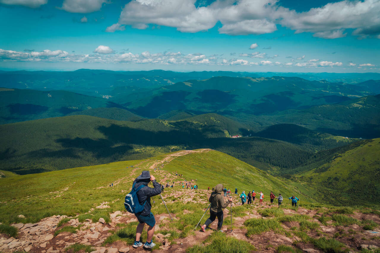
From the exposed trail, it will be a solid 2 hours of climbing up the steep trail until you arrive at the summit. You might be surprised at how many people are doing this trail, but since it is the highest mountain in Ukraine and is considered a pilgrimage trail for Ukrainians, it is understandable.
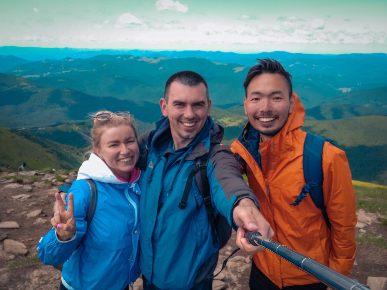
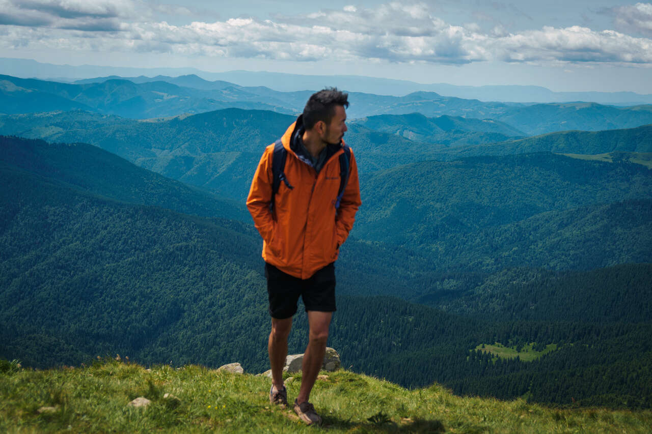
Congratulations, you are now at the top of Ukraine! Now you can see the Carpathians in their full glory from both sides of Hoverla. The beautiful rolling green hills and mountains of the Carpathians stretch as far as the eye can see!
Up at the top, it can get very windy and cold, so if you are in need of a hot beverage, fear not. There were a few locals who were selling hot drinks and snacks to tourists at an inflated price, but you deserve a reward, so get yourself a coffee, sit, and enjoy the view.
You might arrive a little faster than your tour group, so just relax and enjoy your time up there. Once you are ready to go down and your guide has arrived, be sure to tell him that you are heading down. The way down is pretty straightforward and takes only an hour or 1.5 hours to complete.
Once everyone in your group arrives back at the parking lot, you will start heading back to Yaremche. Another 1.5-hour ride and you should be back in Yaremche, strong and proud! Time to celebrate your accomplishment with a well-deserved meal at Krasna Sadyba Restaurant!
Where to Eat and Drink in Yaremche?
Eat Local Food at Krasna Sadyba Restaurant
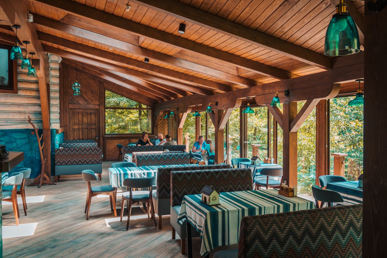
Krasna Sadyba Restaurant has got to be my favorite restaurant in Yaremche. They serve real, authentic Ukrainian food, as well as grilled steaks and fish for you to indulge yourself in.

The restaurant is in the center, yet it's tucked away in the corner where it overlooks the thick green forest of the Carpathians. The interior is also cozy and spacious, with a fire and oven where they grill their meat and seafood for you. There is no better way to treat yourself after hiking Hoverla than to feast at Krasna Sadyba Restaurant.
Have a Cup of Coffee at Barberry
If you are looking for a nice cup of coffee or a sandwich to relax during the day, Barberry is a great place to be. They serve great coffee, desserts, and ice cream, as well as sushi if you are somehow craving it in Ukraine 😅.
Other Things to Do in Yaremche
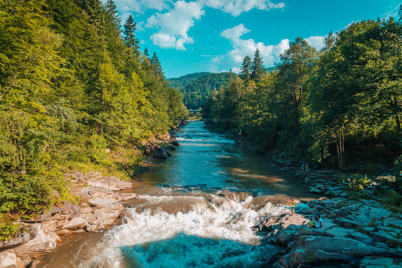
1. Visit Probiy Waterfall
- 📍 Location: Probiy Waterfall [Map Link]
As mentioned before, Probiy Waterfall is a nice place to stop on your way to hike Mt. Makovytsia. The waterfall is an 8-meter-high rushing waterfall on the Prut River with restaurants, souvenir shops, and an observation bridge that you can explore.
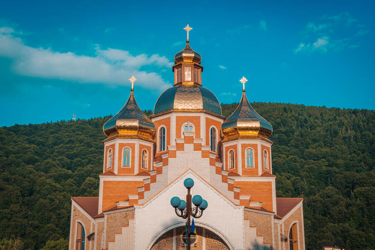
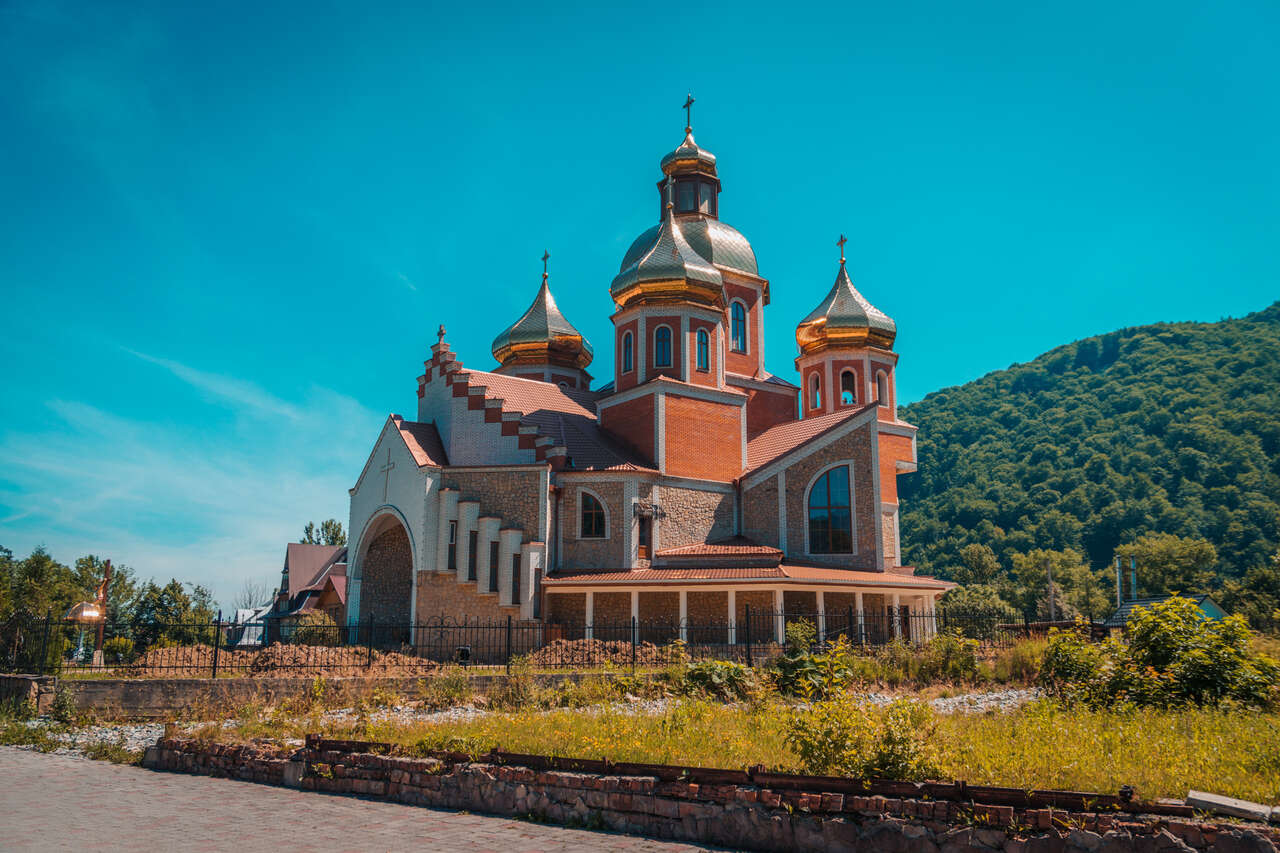
2. Check Out th Nativity of John the Baptist Church in Yaremche
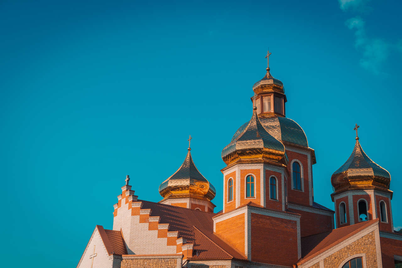
- 📍 Location: Nativity of John the Baptist Church [Map Link]
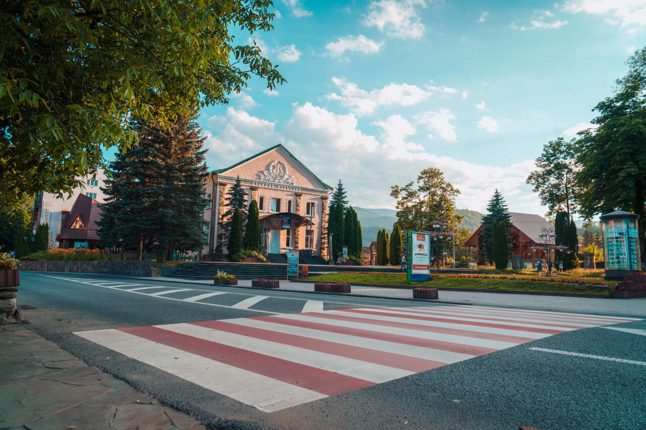
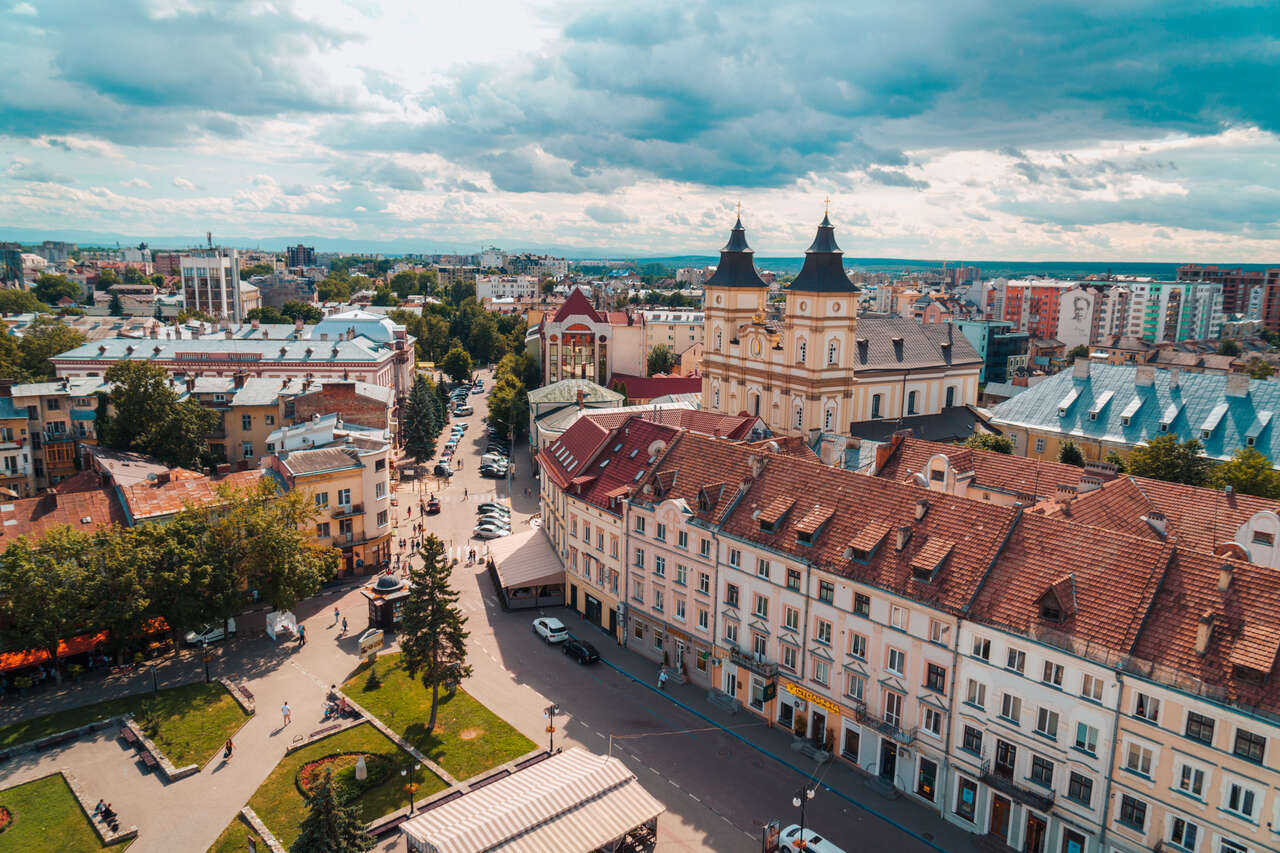
The Nativity of John the Baptist Church is one stunning church to visit in Yaremche. With its red brick exterior, golden domes, and central location, the Nativity of John the Baptist Church is probably one of the most iconic architectural structures in the city, and it is just across the main street from Yaremche train station.
3. Buy Authentic Carpathian Souvenirs
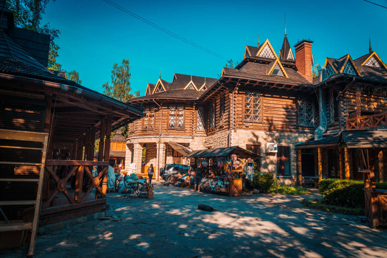
- 📍 Location: Probiy Waterfall [Map Link]
The Carpathians are rich in culture that is totally different from what you might find in Kyiv or Lviv. So, if you are looking for unique gifts from your trip in the Carpathians for your friends and family, be sure to check out some of the souvenir markets in Yaremche.
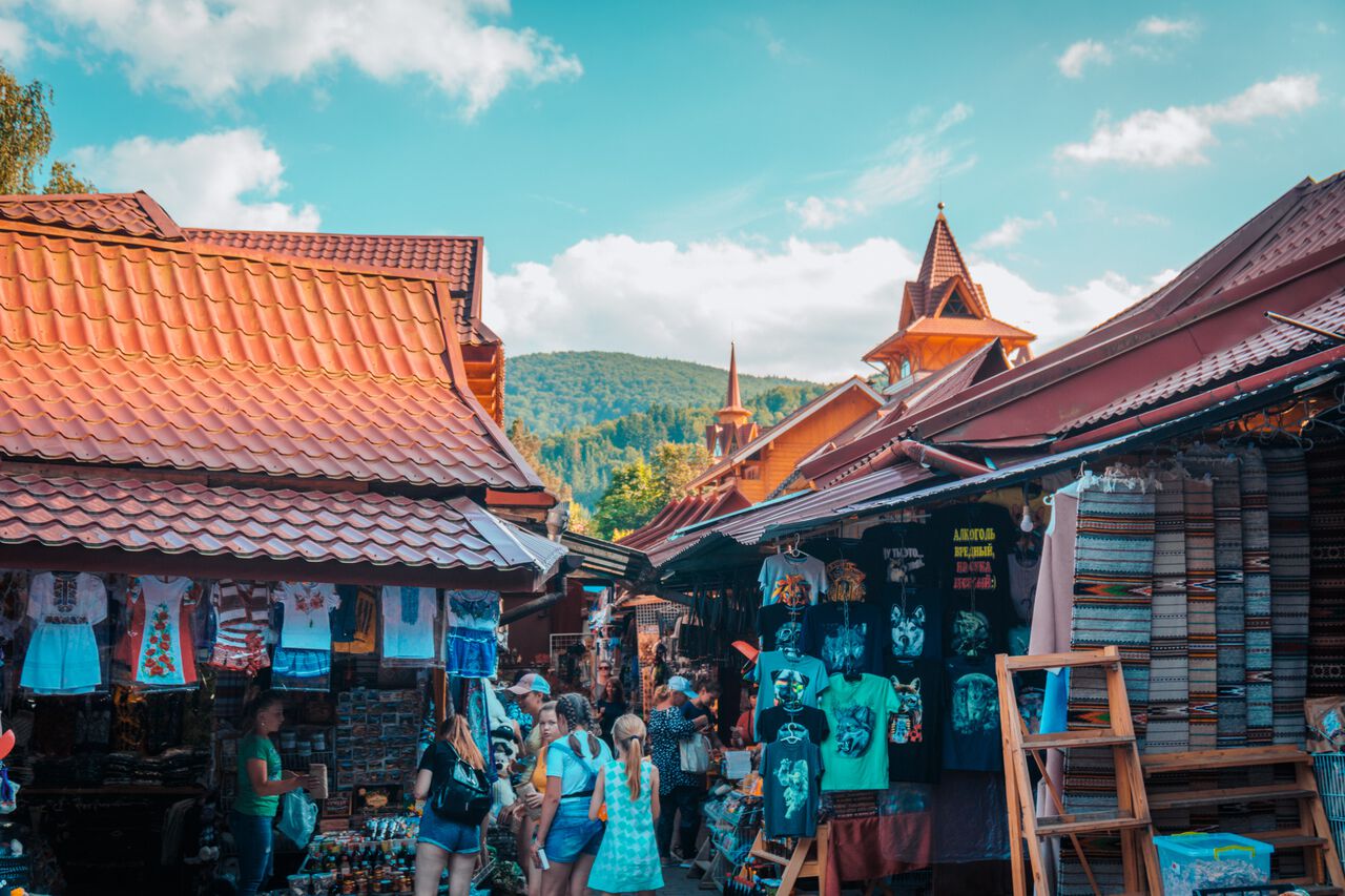
There is a big one at Probiy Waterfall across the bridge, and there is another souvenir market just before the main road crosses Prut River South from the main area where the church is in Yaremche.
4. Visit Bukovel, Ukraine Largest Ski Area
- 📍 Location: Bukovel, Ukraine Largest Ski Area [Map Link]
- 💰 Entry Fees: 2 USD bus ride
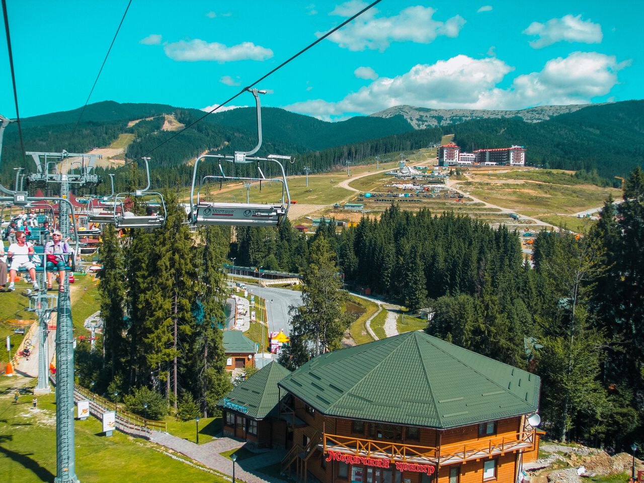
Photos by Frank Treak.
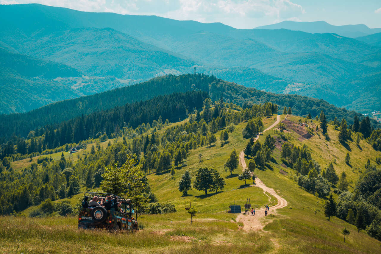
Last but not least, you can go on a day trip to Bukovel, one of the largest ski resort areas in Ukraine. During the summertime, there are several activities you can do there, such as hiking and taking a panoramic lift for a stunning view of the city and the landscape around it.
Needless to say, if you have a day to spare, I would recommend spending it in Bukovel. To get there, you can take a 40-minute bus ride from Yaremche to Bukovel and back for only 2 USD.
You can book the bus from 12Go or you can also charter a taxi for around 400-500 UAH both ways, including wait time.
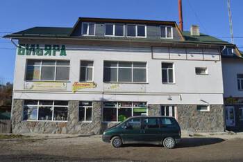
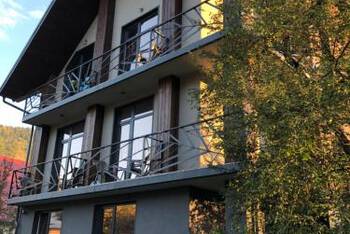
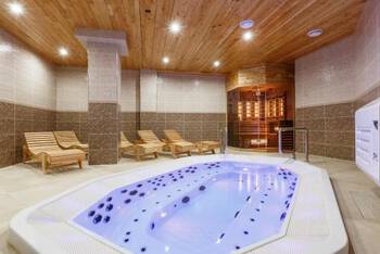
Where to Stay in Yaremche?
When to Visit the Carpathian Mountains in Ukraine?
If you are interested in summiting Mt. Hoverla, the highest mountain in Ukraine, the trail opens from May - September, so anywhere between this period is the best time to visit Yaremche in the Carpathian Mountains in Ukraine.
Due to its higher altitude, the weather can be quite cool even in the summer. You should be able to hike in shorts and t-shirts around Yaremche in the summer months of June - August just fine, but you will need windproof and insulating jackets for Hoverla even during the hottest time of the year as the temperature hovers around 6°C - 17°C and can go down to -2°C during shoulder seasons.
Where to Base to Hike the Carpathian Mountains in Ukraine?
Within the Carpathian Mountains in Ukraine, many people have suggested several places to base yourself out of, such as Ivano-Frankivsk or Kolomyya. However, from my personal experience, none of these cities are actually in the mountains, and they are not the ideal locations if you are planning to hike in the Carpathian Mountains.
The best base to go hiking in the Carpathian Mountains in Ukraine is Yaremche, a town further south from Ivano-Frankivsk and Kolomyya. Yaremche is surrounded by mountains, making it a great place to base yourself in the Carpathian Mountains. There is even an epic day hike you can do straight from the city in Yaremche.
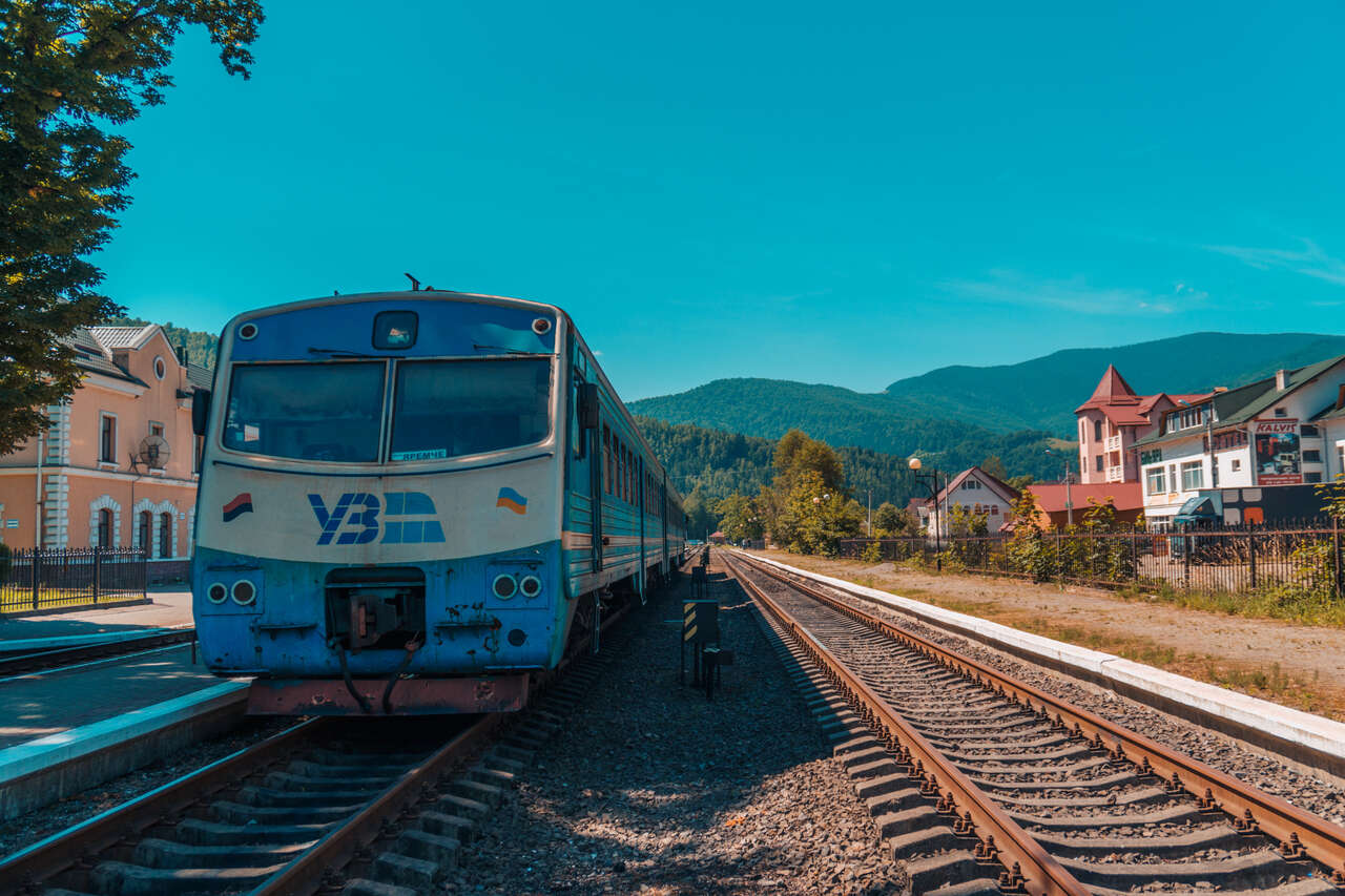
Local tour companies also run transfer services to many of the mountains in the region, so you can easily get information on hiking trails here and start hiking. The town is also easily accessible from Lviv with a 5-hour direct train.
Yaremche used to be a remote sleepy town that was not worth staying in back in the day, but now, as of 2019, the city has developed so much that it is now the best place to use as a base for exploration in the Carpathian Mountains.
They now have cheap hostels as well as expensive resorts, good restaurants, and transportation options. If you are looking for a base to go hiking in Ukraine's Carpathians, Yaremche is the place to be.
How to Get to Yaremche?
In order to get to Yaremche, first and foremost, you will have to get yourself to Ukraine, and there are two major cities you can fly into: Kyiv and Lviv.
Lviv is much closer to the Carpathian Mountains, so I would recommend that you fly there. Unfortunately, it is not a big hub, and if you are traveling from outside of Europe, you will likely have to go through Kyiv.
To find a cheap flight to Kyiv, I would recommend that you use Skyscanner or Expedia to look for the cheapest route and schedule so you can compare and pick the best one.
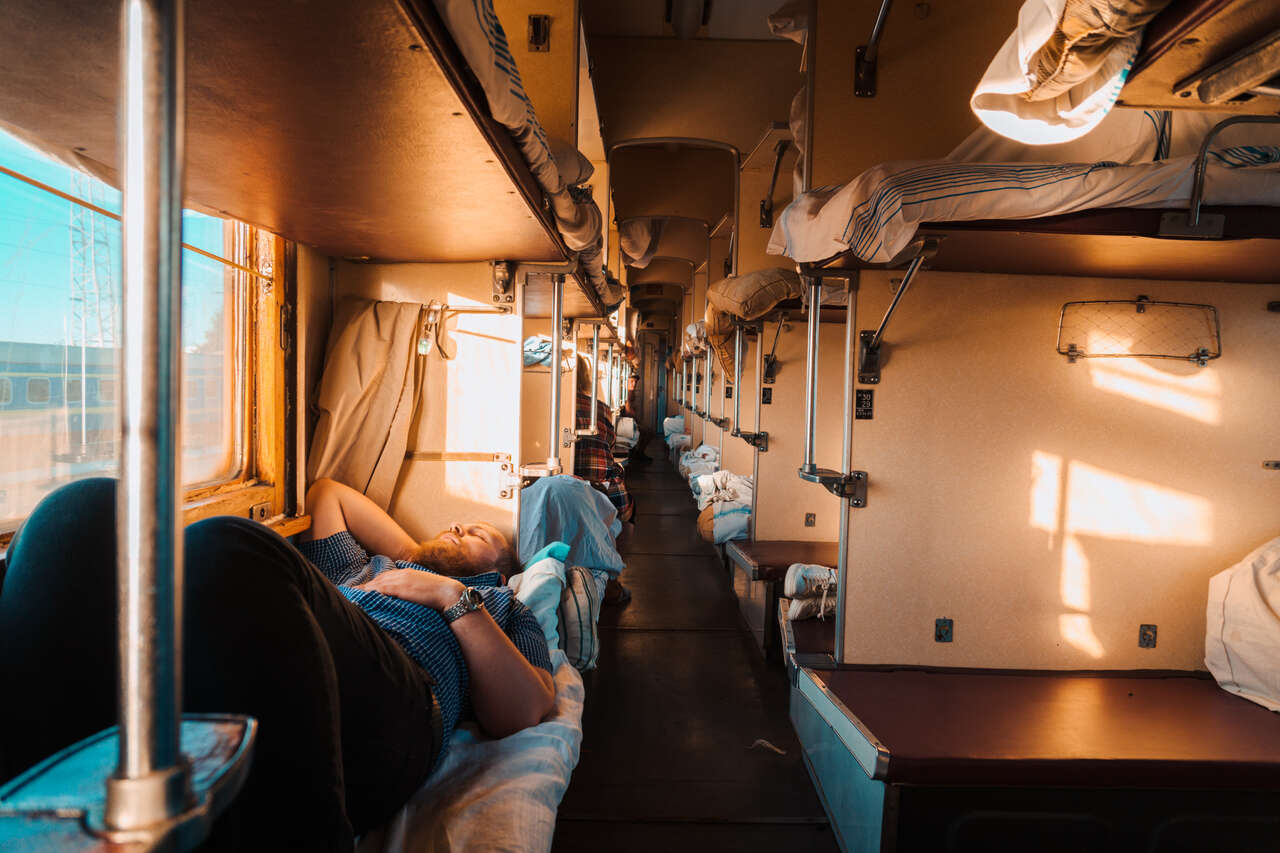
After you arrive in Kyiv, there are several overnight trains and buses that go directly to Yaremche. The journey should take around 10 hours by bus and 16 hours by train. You can check the train and bus schedules at Tickets.ua. If you cannot find Yaremche, try copying and pasting Яремче into the search bar. Iaremche should appear, which is the same as Yaremche.
If you are already in Lviv, there are 3 direct trains that you can take. I took the one that leaves at 06:35 and arrives at 11:01. The journey took 4.5 hours and cost around 150 UAH.
You can book your trains online through 12Go or through Tickets.ua. You can simply pay with your credit card, and you will receive an email with a QR code. All you have to do is show it to the ticket master when you are on the train.
How to Get Around Yaremche and the Carpathian Mountains in Ukraine?
One of the reasons why Yaremche is such a good base for hiking in the Carpathians is that the town sits right in the middle of a valley, so you are within walking distance of many mountains, such as Mt. Makovytsia, and only a 30-minute car ride away from Hoverla, the highest mountain in Ukraine.
Yaremche is a small town, and so most of the attractions and things to do are within walking distance. For places further away like Bukovel and Mt. Hoverla, you will either have to take a bus or a shared transfer service, which can be booked in Yaremche.
For more information on local tour companies and the day trips they are operating, you can check out Yaremche Official portal. Unfortunately, they are all in Russian or Ukrainian, but you can use Google Translate to translate them into English and get some ideas on the day trips they offer.
How to Get to Mt. Hoverla from Yaremche?
To get to Mt. Hoverla from Yaremche, you will have to rely on a shared minivan operated by local tour companies that take day-trippers to the trailhead every day.
When you arrive, you will have no trouble finding these local tour companies, as you will be bombarded with people giving you brochures of different local tour companies offering similar trips at the same local rate (very cheap). They are all pretty much the same, to be honest, so you can pick whichever.
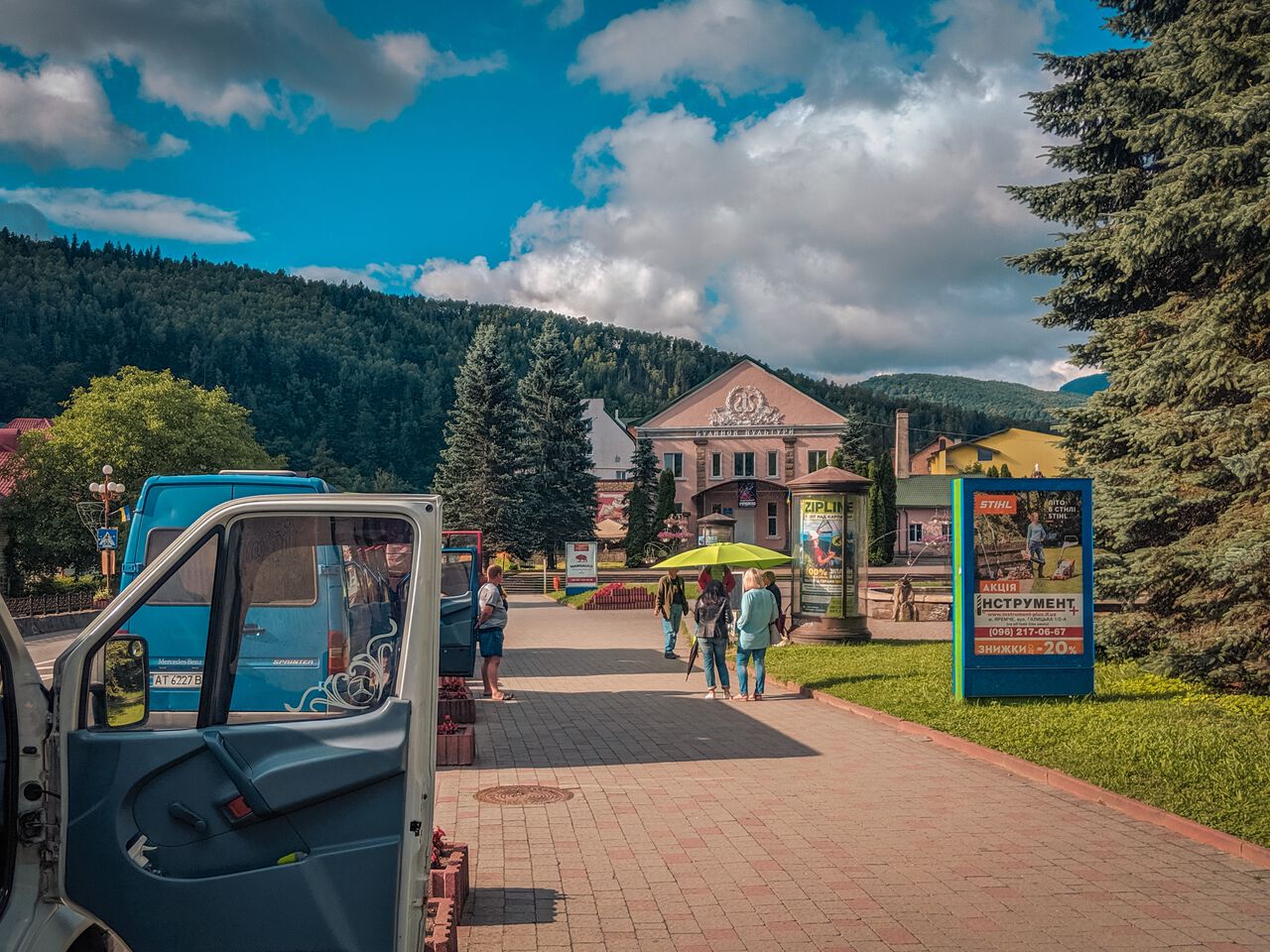
I went with Karpaty company where they have their green umbrella booking person at the Fountain across the road from the Nativity of John the Baptist Church in Yaremche.
You can book a day trip from one of these people under an umbrella that is everywhere along Yaremche's main street. Pay them and show up at the right time the next day.
The day trip includes 2-way transfers from Yaremche to Hoverla trailhead and a non-English speaking guide to guide you along the trail. It costs 300 UAH per person, and the tour begins at 9 AM. You will be back in Yaremche by 6 PM.
How Many Days to Spend in Yaremche and the Carpathian Mountains in Ukraine?
There are quite a few hikes and day trips you can do from Yaremche, so I would say that spending at least 2 full days is recommended in Yaremche.
Day 1: Spend your first day exploring Yaremche, visit the Probiy Waterfall on your way to hike the Makovytsia mountain, a 7 km hiking trail that will take you 3 hours to climb and 2 hours to descend. Make sure to book a tour to Mt. Hoverla for tomorrow before you end your first day.
Day 2: A day trip to summit Mt. Hoverla. It will take the whole day from 9 AM - 6 PM.
Day 3 (extra): Visit Bukovel for a day and spend the rest of the day back in Yaremche.
How Much Money Do I Need for Yaremche?
Yaremche is a resort town, so things may not be as cheap as you would hope, but still very affordable compared to Western standards. Let's begin our calculation based on a minimum 2-day, 3-night stay.
Accommodation: 10 USD per night, so 30 USD (758 UAH) total.
Food: The food costs around 100 UAH per meal, totaling 300 UAH for a day. However, since we will be hiking both days, we can deduct 50 UAH because you will have to prepare your own lunch. In total, it will be 500 UAH for 2 days of food.
Transportation: For this itinerary, you will only pay for the trip to Mt. Hoverla, so the total will be 300 UAH.
Activities: Both hiking trails, Mt. Makovytsia and Mt. Hoverla, will require you to pay for the park entrance fee, which is 30 UAH each, so a total of 60 UAH.
Total Budget for Hiking in Yaremche for 2 days: ~1,618 UAH (64 USD).
Is it Safe in Yaremche?
Like most of western Ukraine, Yaremche is very safe. It's a small mountain town, so petty thefts are almost nonexistent. You are safe to hike around carefree.
Which tourist SIM card is best for Yaremche?
Update: If your phone supports eSIM, I highly recommend checking out Airalo, a global eSIM marketplace. It allows you to stay connected affordably while traveling in Yaremche, Ukraine without having to switch out your physical SIM card.
Gone are the days when you needed to scramble to find a local SIM card at an airport upon arrival. You can purchase an eSIM before your arrival, and you'll be good to go. If your phone doesn't support eSIM, here is how you can get a local SIM card in Yaremche, Ukraine:
The hostel I stayed at did not have any WIFI, and I only found 2 restaurants with not fast but manageable WIFI. So, if you want to stay connected while in Yaremche, be sure to get a local sim card before you arrive.
You can either get the one from Vodafone or Kyivstar. They both offer similar plans with data ranging from 2GB to unlimited, costing between 55 UAH and 220 UAH.
For more information about Ukraine local SIM card: Ukraine Prepaid Data SIM Card.
Tips: To stay connected with people at home, be sure that you have a VPN, such as ProtonVPN, installed before traveling. It's FREE, and you can gain access to services that may be blocked in certain countries.
What to Pack and Things to Prepare before Hiking the Carpathian Mountains in Ukraine?
- Water bottles: It is recommended to have at least 2 liters of water for each trail you are doing. Ukraine in the summer can be quite hot, especially at a lower altitude trail like the one going up Mt. Makovytsia, so make sure you have enough water. I always carry my 2-liter hydration pack, which I recommend so you don't have to stop to stay hydrated.
- Sturdy shoes that can withstand muddy trails: The trail can get quite muddy if it rained the day before, so be sure your shoes can handle that. If it's been sunny, then a regular trainer should get the job done. These Timberland Shoes are my go-to hiking boots in most situations.
- Wind-proof and insulating jackets: This only applies to the Mt. Hoverla trail since it gets very windy and cold up there due to the altitude (2,061m) and the exposed trail. Here are the jackets I recommend you get for the trip: fleece jacket and the beautiful orange Columbia outer-shell jacket.
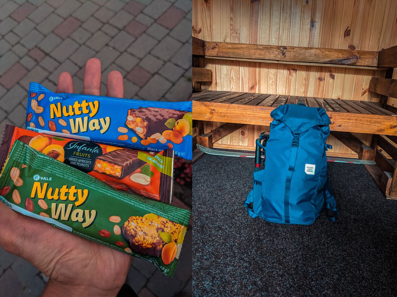
- Lunch and snacks: Both trails take around 5-6 hours, so you will have lunch and snacks while on the trail. Therefore, prepare some before you set out on the hikes.
- A Daypack: You will need a daypack to carry all your gear with you when you are out and about. During this trip, I used the Herschel Supply's Barlow Trail Collection Backpack to carry everything with me. It is lightweight with good capacity and stylish as hell.
- Maps.me: Maps.me has both hiking trails I recommended in this travel guide in case you get lost, so be sure to download the app and make it offline before you set out on the hike. The app is available on both Android and iOS. Make sure you download the offline maps before you hit the trail.
Disclaimer: This post may contain affiliate links. See our disclosure policy.
First Published:
5 Comments
I want to travel to bukovel, but i dont have any idea where to start. After booking room in local apartment nearby, how can i book for ski passes and how much will it cost me!? Please help n
!
Hey Hussain,
There are 2 buses operating the Yaremche to Bukovel per day by Neoplan at around 9:35 and 16:10. You can book your ticket from Tickets.ua website. It should cost you around 200 UAH. I hope this helps!
Thank you, and can u help me little more!? Do i require ski pass to get to top of bukovel (for sight seeing, because i cannot do skiing)? And if yes, how much will it cost me to use cable chair?
Thanks Pete for that great info on Yaremche! I am searching for Ukraine's Hiking Paradise, wherever that may be. You make a good case for Yaremche. I hiked from Kharkov to Kiev (about 1-month), mostly forest, rivers and farming villages. Great experience but saving the best for last (Carpathians). One question: if you had more time in Yaremche, say 1 or 2 days, are there a lot of other hikes you can do direct from Yaremche, or at least within a short marshrutka/minibus ride? i.e. much closer than Hoverla/Bukovel I see on maps the valley shape you mentioned, but can you hike in all directions or just up Mt. M? (Hypothetically I realize since you were only there 2 days)
That's one hell of a feat! To hike from Kharhiv to Kyiv! Kudos to you! I was unable to find other more accessible trails around. Maybe it's worth looking on Maps.me where they usually plot out trails around an area. I certainly found the trail of Mt M from there. If you speak the language, the tourist info across the street might be of help. Not for tho as I don't speak Ukrainian haha.
When you arrive, there will be people handling out brochures of day trips you can do so you can rely on that too. You will have to buy their day trip though.
I hope this helps!