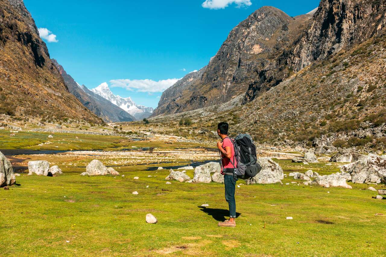
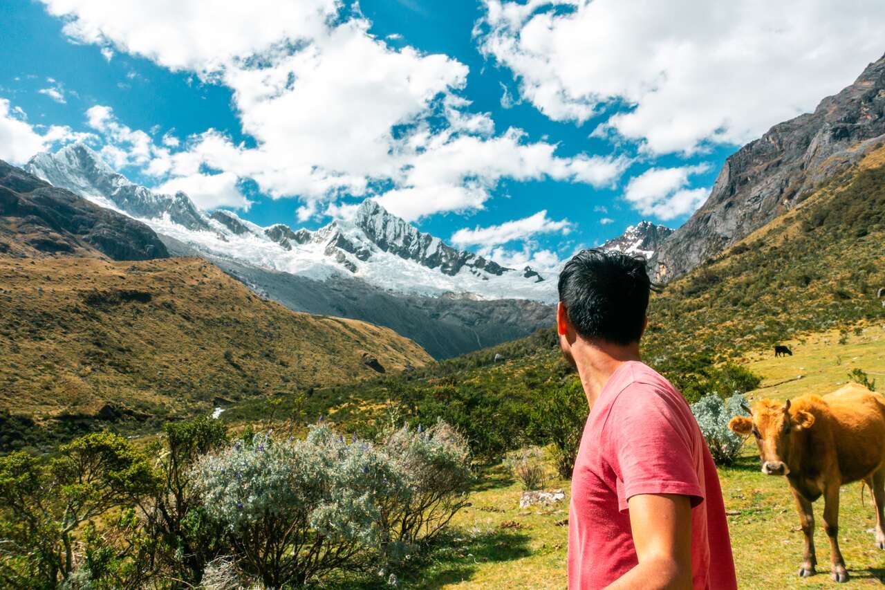
Huaraz is one of the best places to go hiking in the world, even more so than the crowded trails around Machu Picchu. The city is located in the Callejon de Huaylas valley at 3000m above sea level and acts as a perfect base to launch yourself into all the awesome trekking and hiking trails around this part of the Andes.
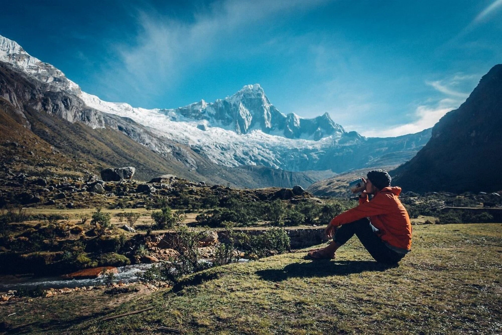
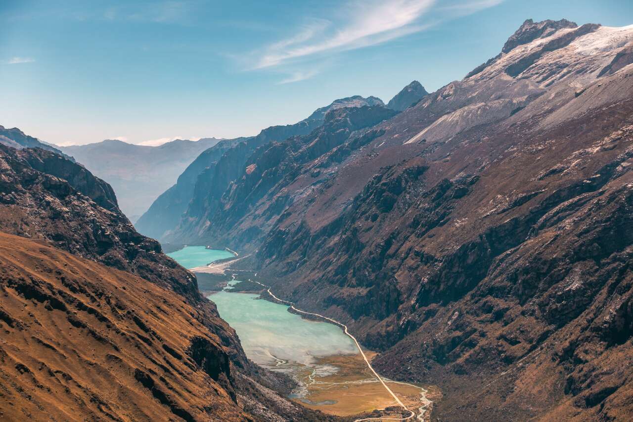
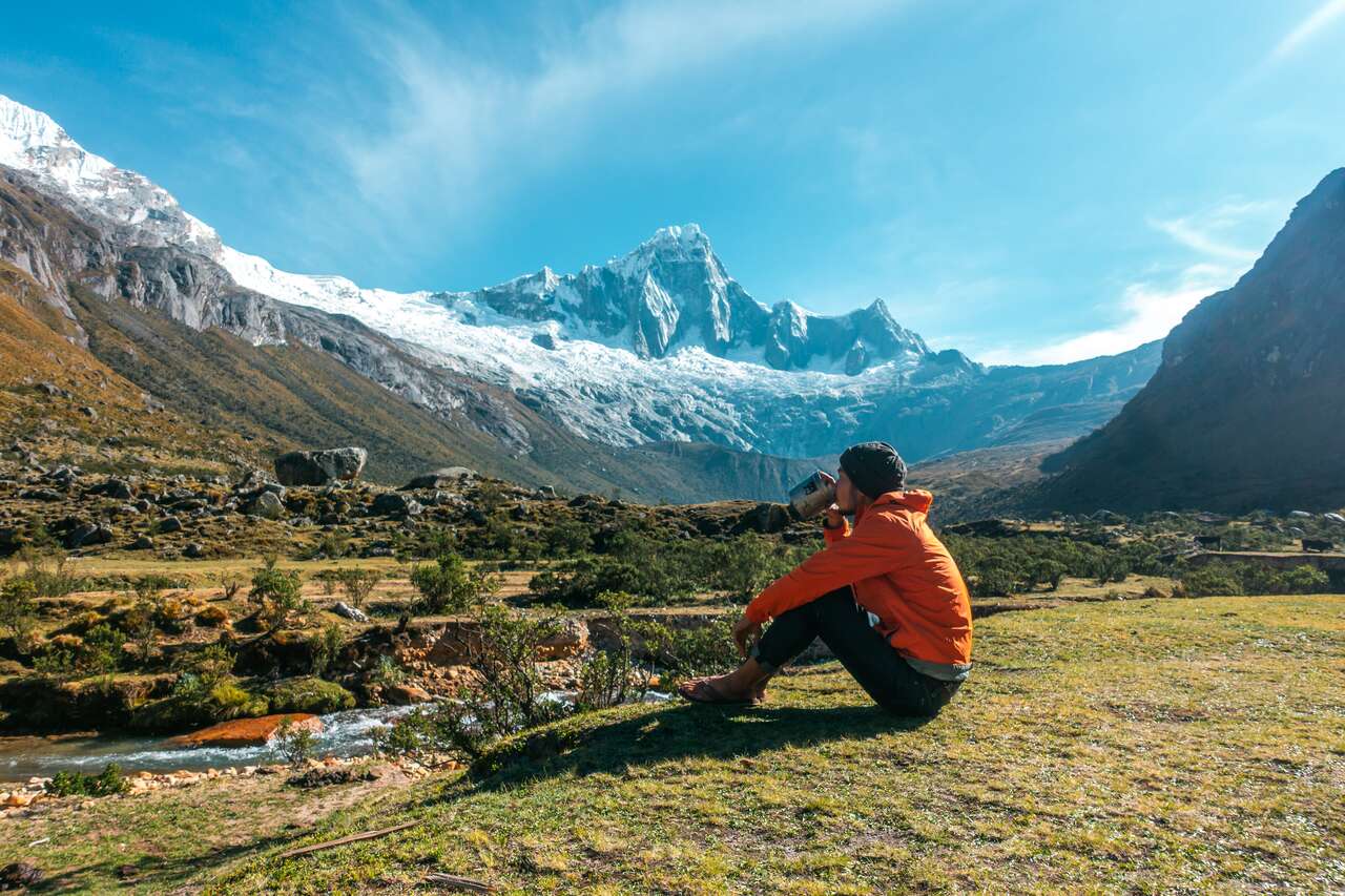
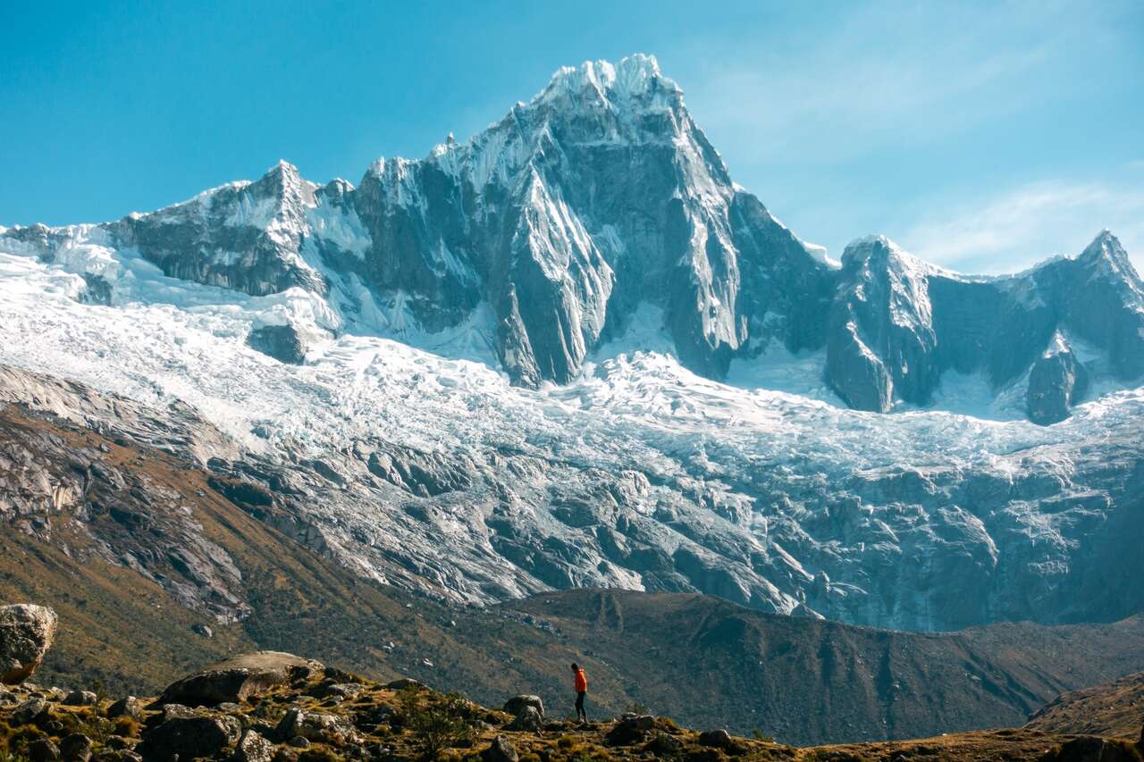
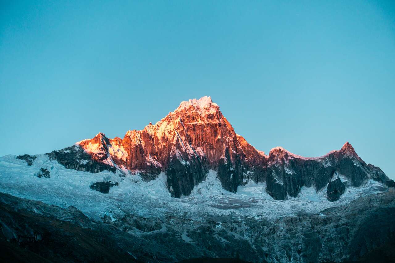
One of the best treks you can do in Huaraz is the Santa Cruz trek, which will take you through the Cordillera Blanca mountains, home to many 6000m+ peaks. This trek only takes 4 days, but it will reward you with the view of a stunning turquoise alpine lake, fantastic views from the high pass (the highest point at 4,750m), and a front-row seat to one of the most prominent mountains in the region, such as Taulliraju (5,830m) and Alpamayo (5,947m), etc.
If you are looking for the ultimate backpacking guide on how to hike the Santa Cruz trek in Huaraz in 4 days, completely independently, you are in the right place. Scroll down and let's plan this epic hiking trip together.

Santa Cruz Trek Hiking Map
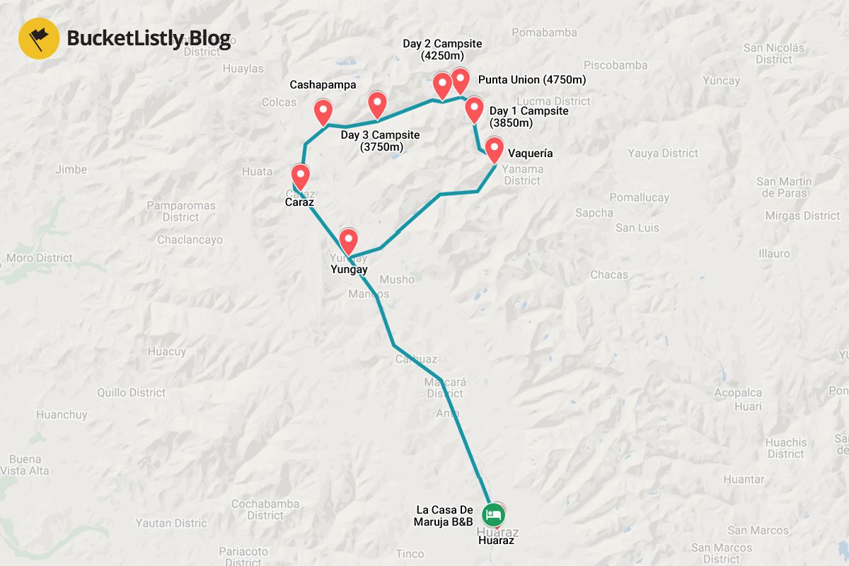
4-Day Santa Cruz Hiking Itinerary
Day 1: Huaraz to Paria (3,850m)
- 🕐 Time: Day Trip
- 📖 Full Guide: A Complete Backpacking Guide to Huaraz
From Huaraz, you will have to start as early as 5:30 AM so that you can make it to the camping site on time before dark. From Huaraz, you can either flag down a collectivo heading northward or you can get one from the city center at Empresas De Transporte.
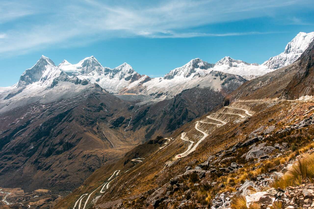
From Huaraz, it should take around 1.5 hours before you have to change to another collectivo. When you arrive, the locals will know exactly where you want to go and ask if you are heading to Vaquería. Get on one of their collectivos and you should be at the trailhead in 2.5 - 3 hours. The road from Yungay to Vaquería goes through one of the most beautiful parts of the mountain in this area, so be sure to be seated by the left window for the best view.
From Vaquería, you can either tell the colectivo driver to drop you off at the park entrance, or you can walk yourself. The path to the trailhead is a little tricky, but there will be some signs that will help direct you to the trailhead. If you get lost, simply ask the locals in town to direct you to the right path.
- La Casa de Maruja BB (Budget)
- Lhotse Hostel B&B (Mid-Range) 👍 Top Pick
- Hotel Churup (High-End)
- Santa Cruz 4 Days Trek (4 days)
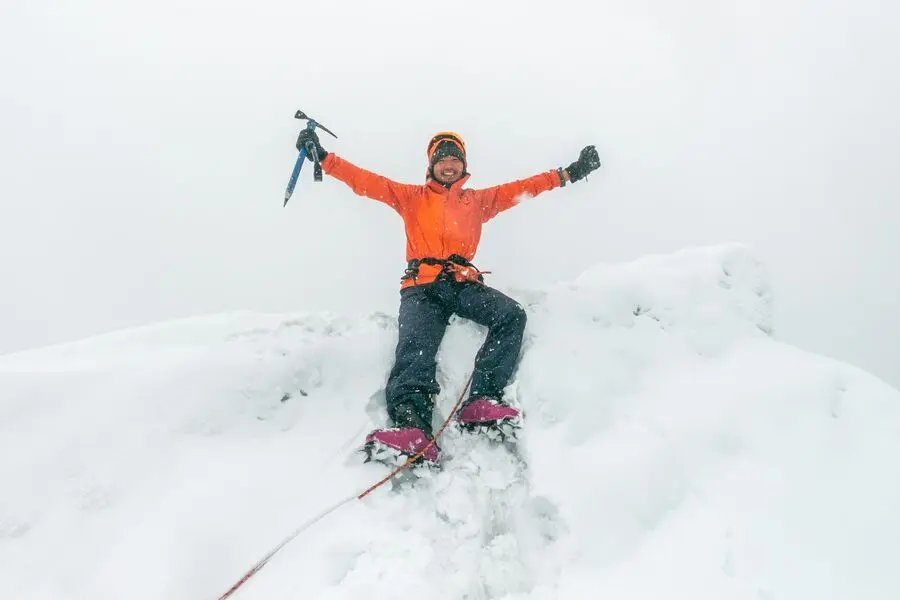
- Summiting Nevado Mateo | Day Trip | Cordillera Blanca | 5,150m (11 to 12 hours)
- Pastoruri Glacier (8 to 9 hours)
From the trailhead, it will be a simple stroll until you reach the entrance of the national park where you will have to pay for a ticket and register. The ticket for 3-4 days should cost around 60 PEN.
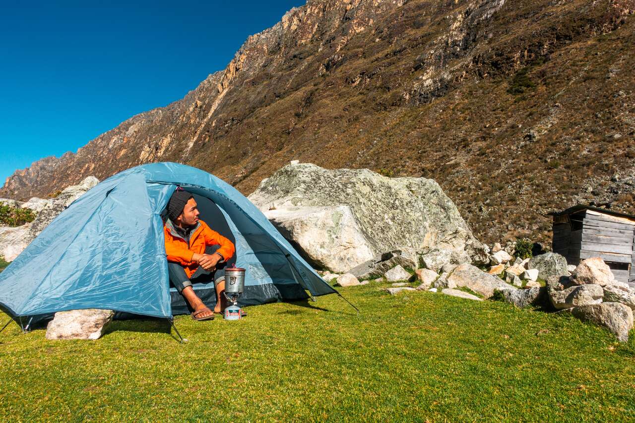
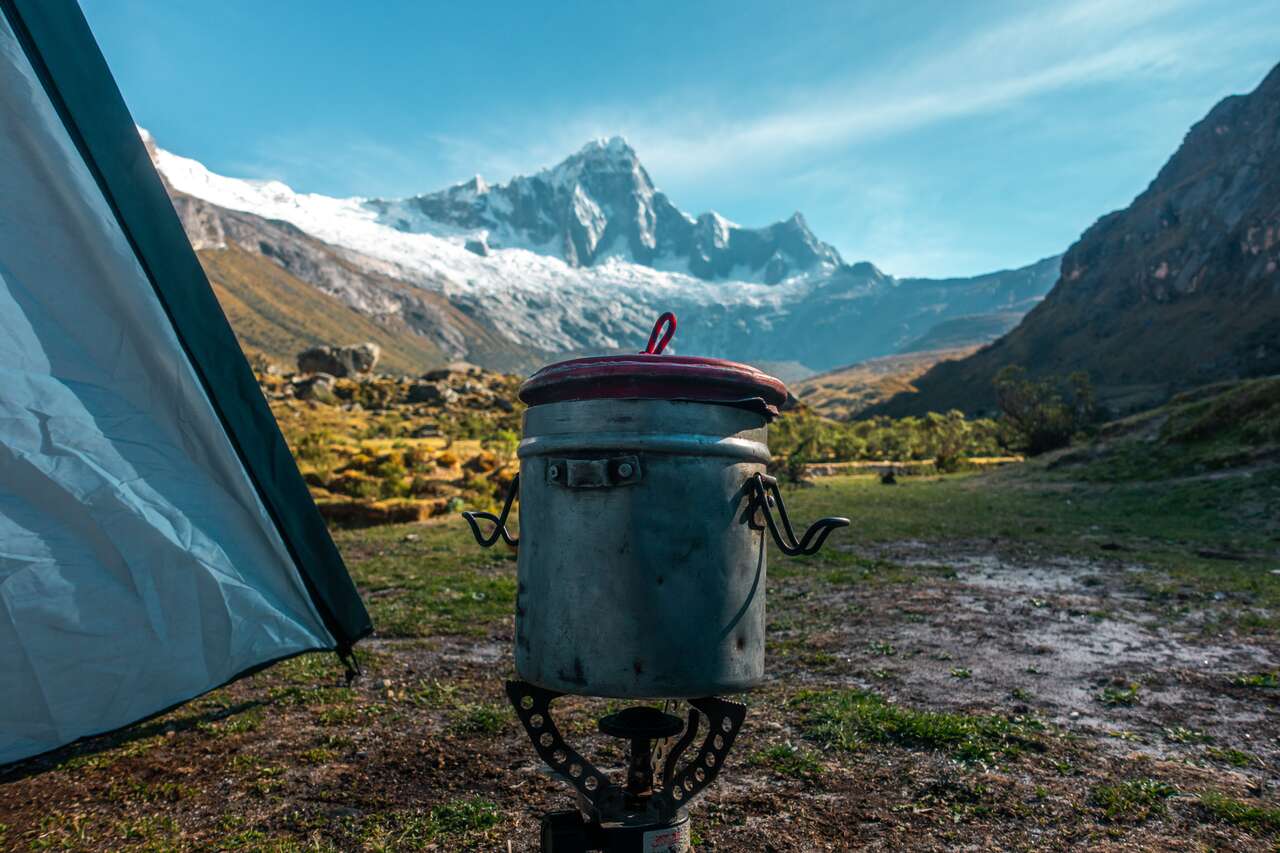
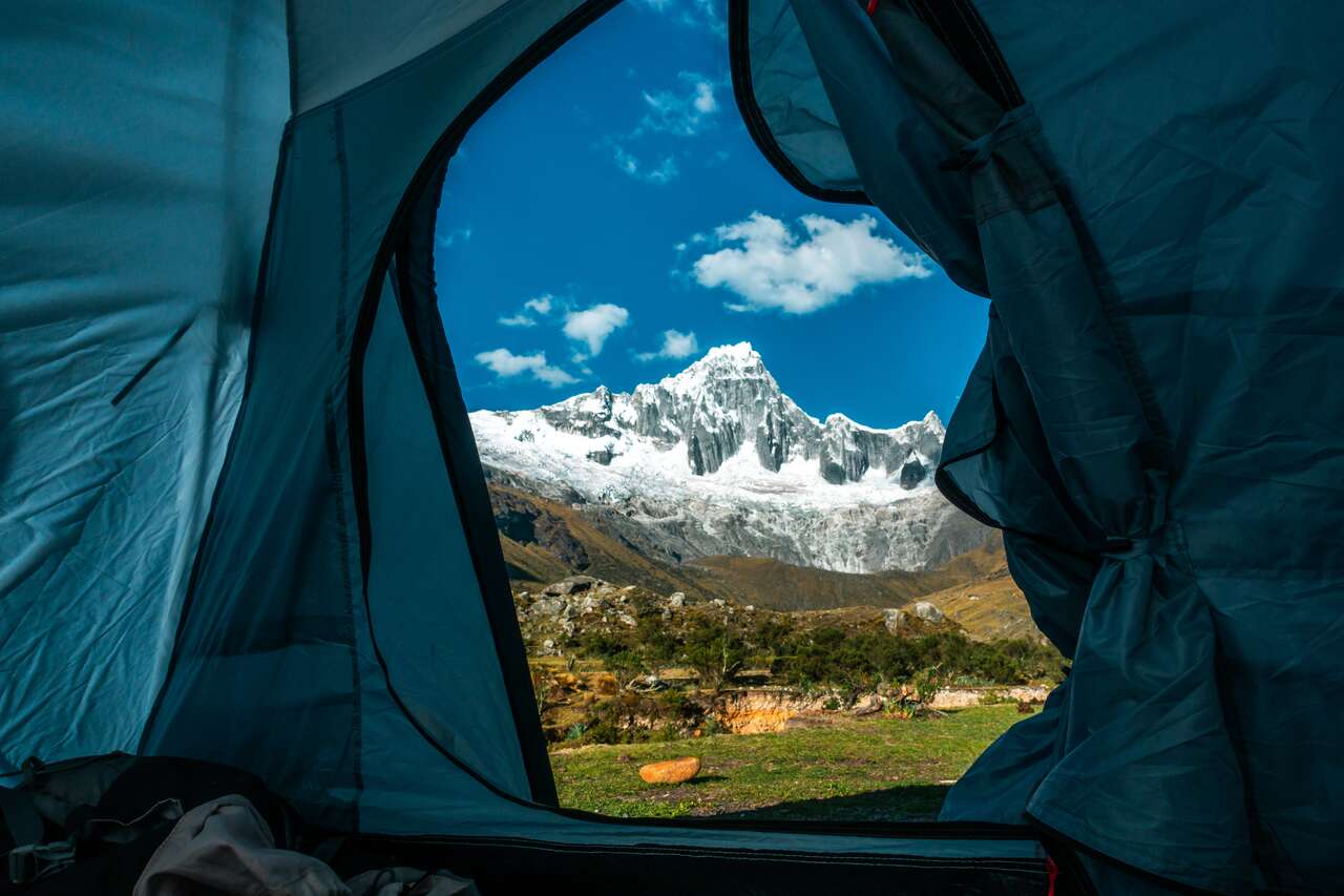
From here, you will walk through the grassland for about 3 hours before you arrive in Paria Valley, where you will set up your tent and camp. The view at the campsite is pretty stunning and will give you a sneak peek of what's to come.
Day 2: Paria to Punta Union to Taullipampa (4,250m)
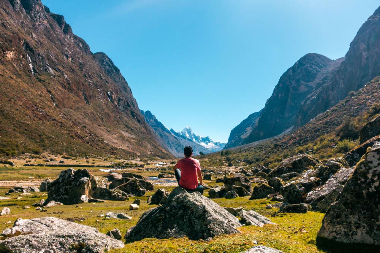
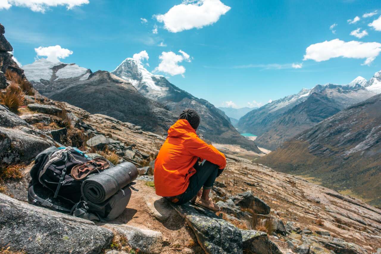
On your day 2, leave as early as you can, as you will be tackling Punta Union (4,750m), the highest point of the trail today. You will begin your day with a steep climb up through the valley, and when you think it can't get any steeper, wait until you are approaching the high pass.
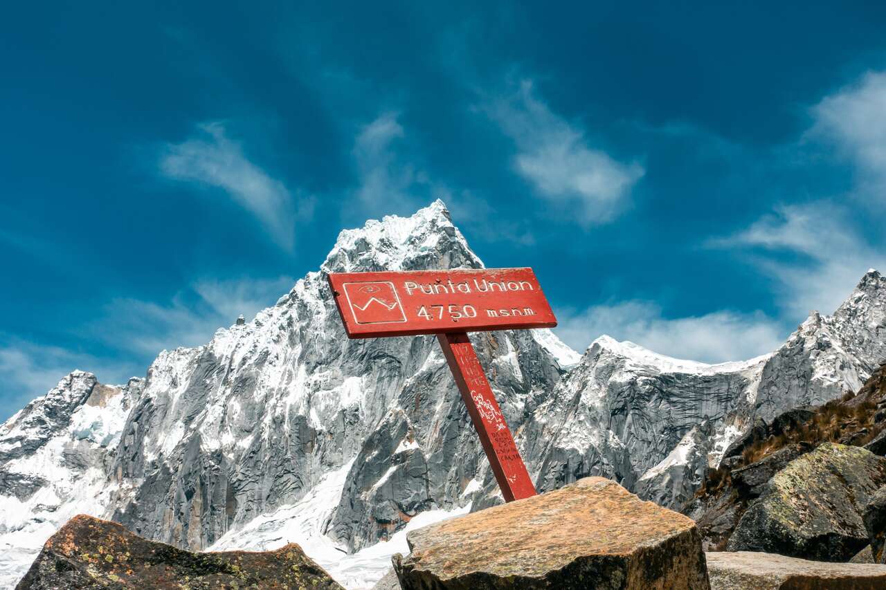
If you haven't felt out of breath ever since arriving in Huaraz, you will now as you ascend up the pass to 4,750m. Slowly but surely, you will arrive at the top, and you will be rewarded with a stunning view of the valley where you can see a pristine turquoise lake that you will pass through the next day.
Walking down is pretty simple and should not take you too long. You should arrive at the Taullipampa campsite in about 6 - 7 hours from the Paria campsite.
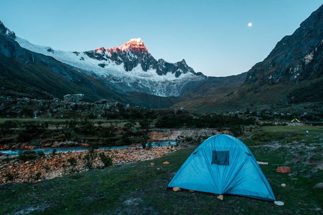
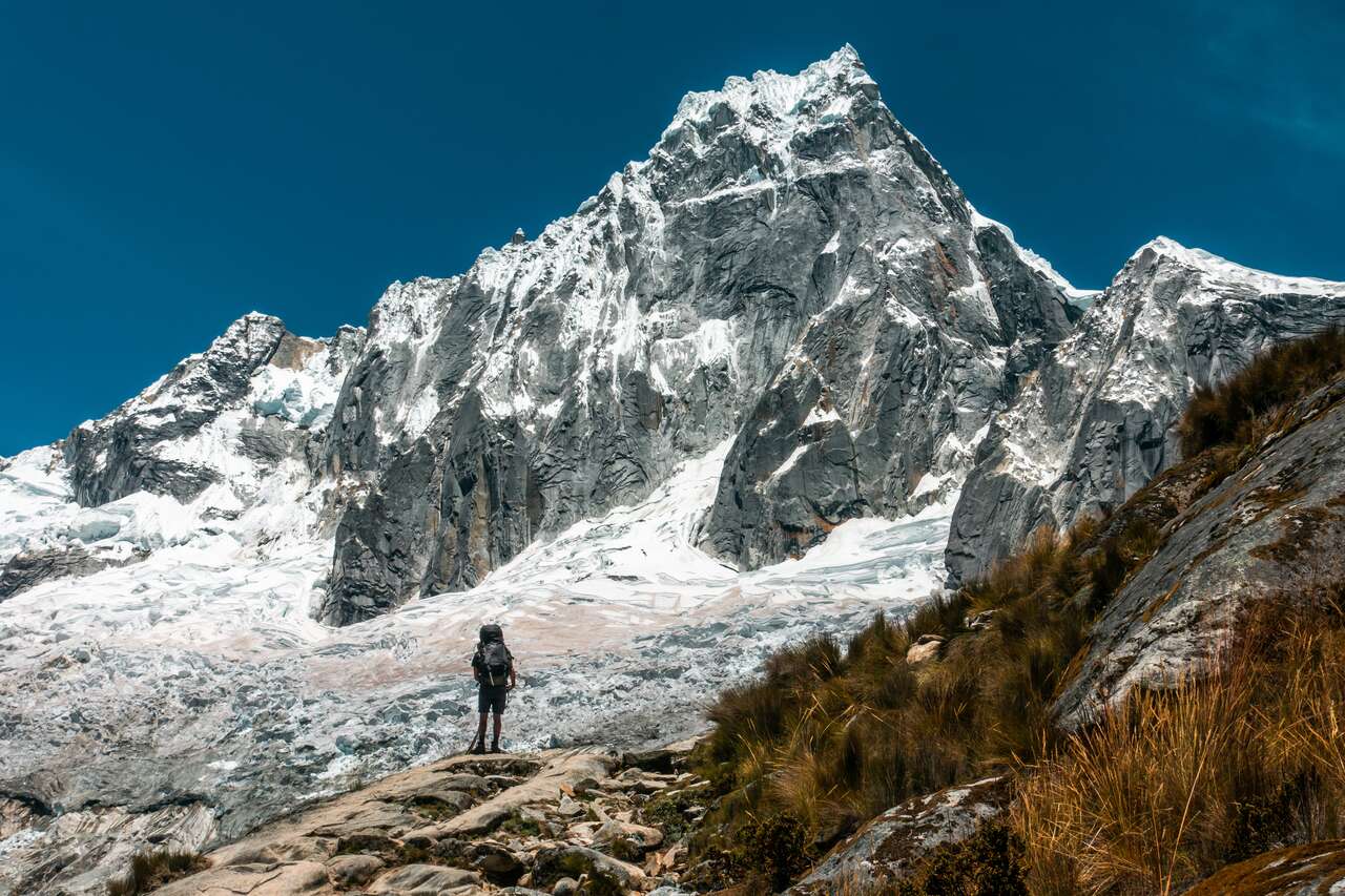
From here, you can pitch a tent right in front of the mighty Tawllirahu mountain and rest for the day. You can also take a side trip to the Arhuaycocha Alpamayo viewpoint, either in the afternoon or the next morning.
Day 3: Taullipampa to Llamacorrel (3,750m)
You can wake up super early and do a side trek from here to the Arhuaycocha Alpamayo viewpoint, which should take you around 3 hours. Then, you can start heading down the valley towards the Jatuncocha lake.

Today is a simple stroll down the valley and a long-ass walk through the sandy plain before approaching the Jatuncocha Lake. From the lake, it should be about an hour before you reach your last campsite, the Llamacorral.
Since there isn't a lot of climbing today, you can enjoy the scenery at your leisure, but don't be too relaxed as you will be covering quite a distance today.
Day 4: Llamacorrel to Huaraz (3,000m)
From Llamacorrel campsite, you will be going downhill for the rest of the trail, and it should take you around 3 hours to reach Cashapampa, where the vegetation becomes a little more lively - a welcome change after hiking through the Santa Cruz trail.
When you arrive at Cashapampa, be sure to sign out so they know you are safe. From the ticket booth, you will have to wait for a collectivo to come and board it heading towards Caraz. From Caraz, there will be plenty of collectivos to pick you up and drop you off in Huaraz.
Want to do it with a tour company? Read more here: Independent or Guided Trekking: Santa Cruz Trekking Guide.
When to Trek Santa Cruz?
The best time to hike the Santa Cruz trek in Huaraz is from May to October as you are likely to have more clear days and mild temperatures during this time. However, there will be a lot more people on the trail too as it is the peak season.
I was hiking in Mid-November, and I was lucky enough to have all four clear days for the hike and almost had the whole place to myself. However, I did wait in Huaraz for a week for the rain to pass, as I had heard reports that some people were caught in a hailstorm and had to turn back two days prior to my hike. If you have time to spare and it is raining in Huaraz, I would recommend waiting for the rain to pass before you begin the trail.
What to Pack for Santa Cruz Trek?
Since you will be trekking independently, the risk is much higher now than when doing a day hike or going with a tour company. It is very important that you are prepared for whatever may come your way and have the equipment to deal with any situation that could happen when trekking the Santa Cruz trail. Here are all the things you need to have with you before you begin your journey.
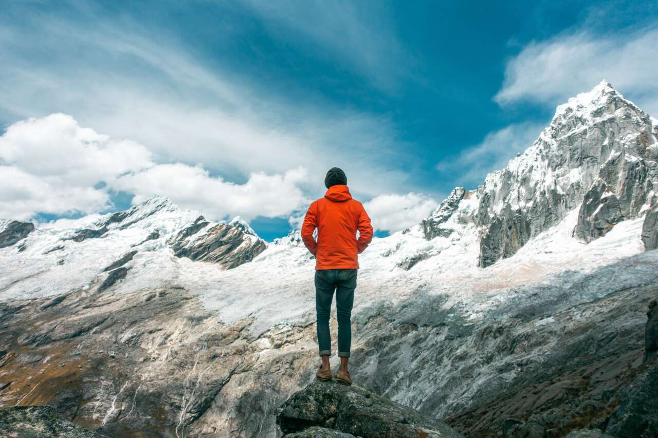
- Weather-proof Jackets and Layers: Since the Santa Cruz trek is a high-altitude hike, you will be going up to over 4500m, and the weather can be cold all year round at that altitude. So, prepare layers and jackets in case of rain. Gloves, sunglasses, thick socks, and a beanie are also good for the cold, and you will definitely need them at night. Here are the jackets I recommend you get for the trip: fleece jacket and the beautiful orange Columbia outer-shell jacket.
- Sturdy Shoes: The trail towards Punta Union can be quite steep, so sturdy shoes are recommended. Most of the trail is pretty easy to walk on, but it gets quite sandy at times, so good shoes will prevent sand from accumulating inside. These Timberland Shoes are my go-to hiking boots in most situations.
-
Camping Gear: If you want to do it independently, you will have to carry all your camping gear with you. That includes:
- 1 x tent (I recommend this 2-person tent)
- 1 x stove
- 1 x gas canister
- 1 x cup
- 1 x spoon
- 1 x sleeping bag (I recommend this Coleman North Rim Sleeping Bag)
- 1 x sleeping mat
- 1 x headlamp (I recommend this Cree LED Headlamp)
- Food and Snacks for 4 Days: You won't be able to buy anything on the trail, so be sure to bring all the food and snacks for the entire journey. Some examples include pasta & sauce, instant noodles, chips, crackers, etc.
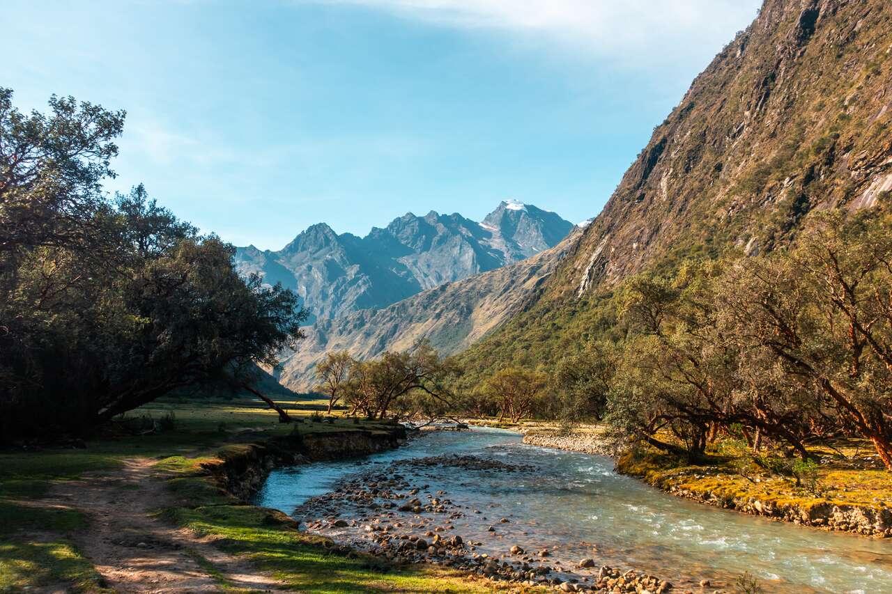
- Water Purification Tablets: There is a river running through the valley throughout the trail, and all the camping sites are situated near a water source, so you can replenish your water supply throughout the trail. However, you might have to purify the water because, God knows, what animals are pooping in the river up ahead. I always carry my 2-liter hydration pack, which I highly recommend so you don't have to stop to stay hydrated.
- Toilet Stuff: Fancy pooping in a hole? Well, better prepare a roll of tissue paper for your business. Most campsites will have a "toilet" dug out for you, so all you need is toilet paper. Also, prepare other toilet stuff like a toothbrush, toothpaste, wet wipes, a towel, etc.
- Cash and Passport: You will need this to register at the ticket office in either Cashapampa or Vaquería at the entrance of the area and pay for the entry fee (25 USD or 65 PEN).
- A Large Backpack: And you need a big backpack to carry all of this gear with you. I highly recommend the 65L Osprey Atmos AG Backpack with its mesh grid back support that makes your backpack lighter, a good capacity to carry everything you need for your trip, and you can't beat the Osprey lifetime guarantee.
- Get Maps.me: Download the Maps.me app on your phone and download the North Peru map for offline navigation. They do have the trail map available, and it's quite accurate. The app is available on both Android and iOS.

Camping Gear Rental
Since Huaraz is known for hiking, there are plenty of shops in the city center where you will be able to rent camping gear for your trip, so you don't have to carry it all the way from home.
I personally brought my own tent (a regular Backpacking double-layer tent) and sleeping bag (-10°C) from home for my South America trip and rented all the cooking gear from a shop called Lalo Travel. There are hundreds of outdoor stores along the Av. Mariscal Toribio de Luzuriaga and the Antonio Raymondi streets, so you can walk around and find the cheapest one with the best quality possible. For a tent, be sure to get one with a wind/rain cover, as it can get cold and windy outside.
Altitude Sickness (Important!)
Altitude sickness (AMS) is a real threat when hiking above 4,000m, which includes this particular hike. Precautions need to be taken seriously before you start hiking the Santa Cruz trek. I would recommend staying in Huaraz for at least 2-3 days before you start your journey since Huaraz is already 3,052m above sea level.
That should help you acclimatize your body before going above 4,000m. You can also spend that time doing day hikes like the Laguna 69 trail, so that you can get used to the altitude.
If you don't feel well even before you start the trail, I would recommend you wait until the symptoms subside before beginning your journey. There are no facilities available for 4 days once you start the trial, so do not risk it.
How to Get to Huaraz?
There are several airlines that fly to Lima, such as Delta, United, and American Airlines for the US, Air France, KLM, and British Airways for Europe and Asia, and Avianca or LATAM for within South America. To find the cheapest deal, be sure to browse through Skyscanner or Expedia and get a flight that works for your itinerary.
From Lima, you can either fly domestically (100 - 150 USD) or take the Peru comfortable overnight buses from Lima to Huaraz, which should take around 8 hours and cost from 7 - 20 USD. I would recommend going with either Cruz del Sur or Oltursa bus companies as they have the most comfortable seats and services out there.
Keep in mind: Buses in Peru operate differently from those in other countries, as each bus company has its own bus terminal in a different location. Therefore, make sure you go to the right one.
How to Get to Santa Cruz Trail Head?
There are two ways you can hike the Santa Cruz trail, and that will determine where you will start your hike. You can either start from Vaquería (3,700m) to Cashapampa (2,900m), or in the opposite direction. I did the latter, which begins at Cashapampa, and I found it to be much steeper on the first day than doing the opposite, even though it begins at a lower altitude.
I would recommend starting your trail from Vaquería to Cashapampa as it is easier for you and shorter too on your first day.
Getting to Vaquería
From Huaraz, you will have to begin as early as 5:30 AM. If you are staying at the accommodation I recommended, all you have to do is stand on the road heading north and wait for a collectivo (minivan) to come. Flag them down and ask if they are going to Yungay. It shouldn't take long until you find one that will drop you off in Yungay. It should take you around an hour and cost you no more than 5 PEN.
If you are not staying on the north-bound road, you can head over to Empresas De Transporte and get a colectivo to Yungay from there.
From Yungay, there will be someone waiting eagerly for you, asking if you want to go to Vaquería. They will direct you to their minivan. This is a bit of a long ride up the winding mountain (one of the most beautiful roads in Peru, so seat yourself by the left window and prepare your camera). It will take you around 2-3 hours until you arrive in Vaqueria.
From Vaqueria, simply walk north up a few hills and start heading west along the valley. You should find a ticket booth along the way at the entrance of the Huascaran National Park. Pay for your 3-day ticket and register your name and how long you will be up there, then begin your journey.
Getting Out from Cashapampa
If you have finally finished the trail, there will be a few minivans waiting at the end, and you will be able to get on one to go down to Caraz. From the bus terminal, there will be plenty of collectivos that will take you all the way to Huaraz. The entire trip from Cashapampa should take around 2 hours and cost you no more than 20 PEN.
Hiking from Cashapampa to Vaquería
If you want to start from Cashapampa, the guide above still applies but in the opposite direction. Instead of asking the collectivo if they are heading towards Yungay, ask them if they go further to Caraz instead.


Disclaimer: This post may contain affiliate links. See our disclosure policy.
First Published:
Last updated:
13 Comments
Is it still possible to solo Travel the area or you have to do a guided trip for 2019
Hey Rodrigo,
Yes, of course. I did it solo myself and there are plenty of solo travelers doing the hikes in Huaraz, although you can hike the Santa Cruz trail solo as well (like I did and this guide illustrated). You could also do it with tours if you don't want to manage the logistic of hiking/camping for 4 days. You can get the tour right at Huaraz when you are there. :)
I hope this helps!
Hey there!!!! Congratulations!! Great Website! I am planning to do the Santa Cruz trek and I wonder if you know if nowadays a guide is mandatory to do the trek (there is a lot of contradicting information on internet). In some forums they say that they won´t sale you a ticket in Huaraz unless you are going with a guide, but that they will sell you the ticket at the park entrance. I am a little worry to get to the park entrance with my backpack and not be allowed to get into the park without a guide. Do you have any information? If a guide is mandatory I rather go trekking somewhere else.
Thanks!
Hey Paulo,
I have seen many recent report, as recent as May 2019 that they were still able to do it independently, no problem but just to be sure, I think you should hop by the Peru Backpacking Facebook Group (https://www.facebook.com/groups/backpackers.inperu/search/?query=santa%20cruz&epa=SEARCH_BOX) and ask about it.
I think requiring a guide rule may have been a response to the missing Canadian hiker last year but it looks like people are still going solo.
If the Facebook Group couldn't help you, I would suggest you go tp Huaraz anyway and ask your guesthouse about it. There are other stunning hikes you can do in Huaraz that isn't not Santa Cruz like Laguna 69, the glacier etc. so it won't be a waste of time if you show up in Huaraz and unable to to Santa Cruz. :)
I hope this helps!
Thanks a lot for the advice!!!!!
Hi Pete , Thank You for this . Very Detailed.
So Day5 is Actually Day 4 or Did you have a Rest Day in Llamacorrel ?
Day 3: Taullipampa To Llamacorrel (3,750m)
Day4 is Missing
Day 5: Llamacorrel To Huaraz (3,000m)
Thanks again
Hey Kevin,
Yes, you are right. It was a typo! Thanks for the heads up! I'll fix it now. :)
Hi! I'm leaving to do the trek in 2 days but I can't find it on maps.me . Any advice about this? Thanks 😊
Hey Fan,
Search for Punta Union on Maps.me once you have downloaded the Northern Peru map and the one dotted line that passes through Punta Union viewpoint is the Santa Cruz trail :)
I hope this helps!
Hi, Pete, did you bring your own backpack for hiking Santa Cruz or rent it? Is is expensive for renting one there?
thanks!